 The River Thames Guide
EXPLORE THE THAMES
Visiting Godstow Lock and Port Meadow
Godstow combines a working Thames lock with the historic landscape of Port Meadow and the nearby abbey ruins. The lock postcode is OX2 8PJ. Plan your approach using the Thames Path route map, checking public parking and current diversions separately.
The Trout Inn features in our guide for its Inspector Morse and Lewis filming connections. Check the pub’s current opening and booking arrangements before planning a stop.
Port Meadow’s grazing landscape has a long history: the original guide describes cattle grazing here over 4,000 years. Respect grazing animals and follow local guidance when walking with dogs.
EXPLORE THE THAMES
Godstow Abbey and Fair Rosamund
Godstow Abbey began as a medieval nunnery in the 1100s. Its former church, court, cloisters and chapter house made up a substantial religious complex.
Historic England’s listing describes the surviving enclosure walls and remains of a probable early-sixteenth-century chapel, possibly in the abbess’s lodging.
The abbey is associated with Rosamund Clifford, mistress of Henry II, and stories involving Eleanor of Aquitaine. Claims that Rosamund bore the king two sons, and scandalous tales about the nunnery’s hospitality towards Oxford monks, belong to the traditions repeated in the old guide and should not be treated as established fact.
The Oxford City Council conservation-area appraisal (PDF) provides further historical context, including the myths surrounding Rosamund.
EXPLORE THE THAMES
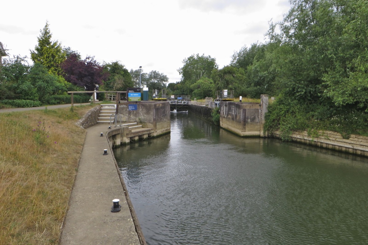
Godstow Lock and Medley Weir
Godstow is the furthest upstream of the Thames’s hydraulically operated pound locks. Our history records its conversion in 1970, when the heavy wooden balance beams were removed.
Before the pound lock built in 1790, a flash weir stood beneath Godstow Bridge. Downstream, Medley Weir was the last working flash weir on the Thames.
The earlier guide gave 1928 for Medley’s removal. The river-history archive Where Thames Smooth Waters Glide records 1937; this guide uses that later date for its final removal.
The first recorded keeper
Thacker names James Bishop as Godstow’s earliest recorded keeper, in July 1798. The lock had opened at the end of 1790.
Research source: F. S. Thacker, The Thames Highway: Godstow. Checked 5 October 2026.
EXPLORE THE THAMES
Meadows and wildlife around Godstow
These wildlife details come from our earlier local account, not a current survey or a guarantee of sightings.
Pixey Mead and Yarnton Meads add to the wider area’s wildflower interest, alongside Port Meadow. These are separate areas of the riverside landscape; use public routes and respect meadow boundaries.
The original wildlife account records kingfishers, woodpeckers and red-breasted mergansers. Sightings vary, and uncommon visitors should not be expected on every walk.
ON THE WATER
Boating through Godstow Lock
King's Lock is 1.81 km (1.13 miles) upstream. The next lock downstream is Osney Lock, 3.87 km (2.40 miles) away by river.
Published lock dimensions
- Length
- 33.52 m
- Width
- 4.95 m
- Fall
- 1.57 m
- Upper sill depth
- 1.52 m
- Lower sill depth
- 1.62 m
Source: Environment Agency distances and measurements. Published dimensions and sill depths do not guarantee navigable clearance. Check water levels, the full guidance and current restrictions.
Consult the lock keeper service and follow the instructions displayed at the lock.
Neighbouring reaches: cruising estimates
| Reach | km / miles | EA estimate |
|---|---|---|
| King’s → Godstow | 1.81 / 1.13 | 14 minutes |
| Godstow → Osney | 3.87 / 2.40 | 30 minutes |
The Environment Agency estimates assume 8 km/h. Add waiting and lock-passage time; conditions can lengthen journeys. These are river distances, not walking distances.
Facilities at Godstow Lock
- card and contactless payments
Checked 5 October 2026 against the Environment Agency facilities guide. Availability can change; check the official guide and signs on site.
Shoal below Godstow
Checked 5 October 2026: the Environment Agency reports a shoal downstream of the lock. Approach and leave the downstream gates with caution, consulting the latest official notice before travel.
Official navigation issues and closures.
Dry-weather passage restrictions
Checked 5 October 2026: the EA still lists restrictions from St John’s to Osney, covering this lock. Passages during keeper hours are limited to one movement each way per half-hour. Overnight closures run from 30 minutes before duty ends until 30 minutes after duty starts the next day. Check current hours and the full notice when planning your arrival.
EA dry-weather navigation notice; arrangements remain subject to review.
BEFORE YOU SET OFF
River conditions at Godstow Lock
Check stream warnings and navigation closures separately. A lack of stream warnings does not confirm that a lock is open.
For the latest information, check the official river conditions service below.
Questions about Godstow Lock
What is there to see near Godstow Lock?
The abbey ruins, Port Meadow and the riverside area around the Trout Inn are the main features covered in this guide. Check current public access before visiting.
Is Godstow Lock near Oxford?
Yes. Godstow is near Wolvercote on Oxford’s north-western edge, between King’s and Osney locks.
When did Godstow Lock become hydraulically operated?
Our local history records the conversion in 1970, when the earlier wooden operating beams were removed.
About this guide
Published by The River Thames Guide. Research additions, measurements and facilities checked 5 October 2026. Sources are linked beside new material; earlier local accounts are retained where identified. Check changing access and navigation arrangements before travelling. Rosamund stories are distinguished from documented history, and Medley Weir’s final removal date has been corrected.
Contains public sector information licensed under the Open Government Licence v3.0. New research is written in original wording; no third-party archive images or maps have been copied. Existing photograph credits and licences are retained.


