 The River Thames Guide
EXPLORE THE THAMES
Visiting King’s Lock and its gardens
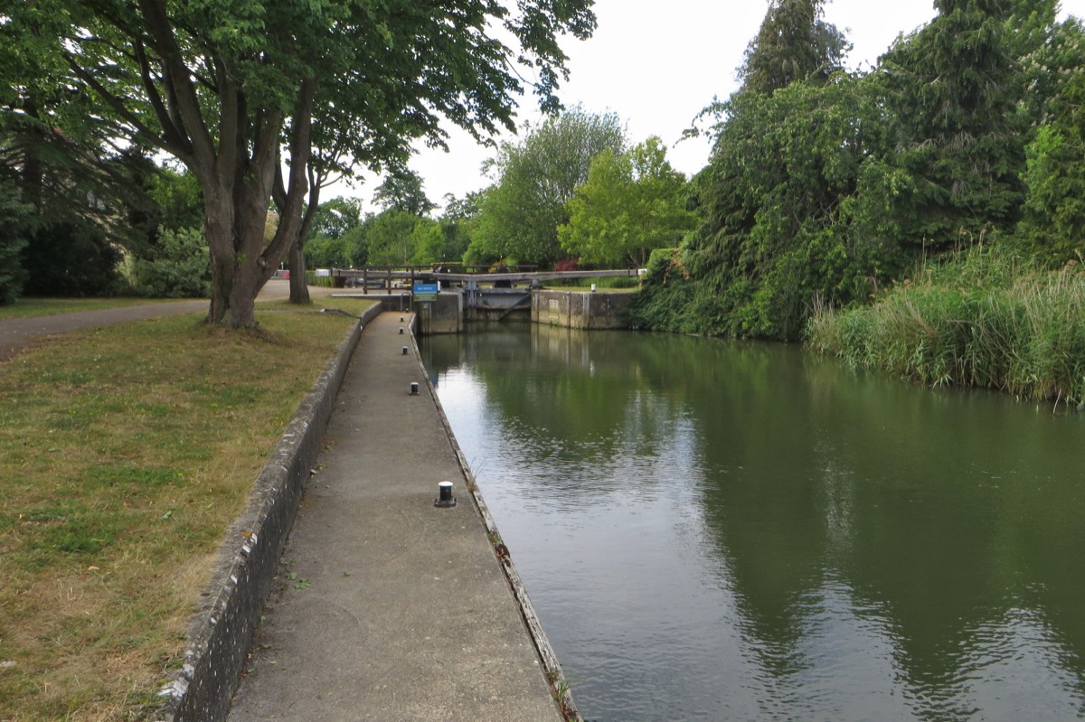
King’s Lock is a countryside stop near Wolvercote, with the lock gardens and the wider Oxford river landscape to explore. The lock postcode is OX2 8PY; check public footpaths and parking arrangements before choosing your approach.
The original guide celebrates extensive gardens said to contain more than 100 species of plants, shrubs and trees. That is a record of the garden’s character rather than a current botanical survey.
Use the official Thames Path map for the route to neighbouring Godstow and Eynsham locks. The river distances below are boating distances, not walking measurements.
EXPLORE THE THAMES
Kingisweire and the history of King’s Lock
The recorded history goes back to 1289, when a flash weir supplied eels and fish for local people. The name Kingisweire has been linked in our original account with “kin”, meaning cattle.
The present beam-operated pound lock and lock house date from 1928. Negotiations by the Thames Commissioners had begun as early as December 1817; proposals and repairs to the old flash weir continued through the following century.
With a published fall of 0.77 metres (about 2 ft 6 in), King’s is among the shallowest Thames locks. Our earlier guide describes it as the second shallowest, the shallowest beam-operated lock and the most northerly lock on the river.
Manual gates and the buck weir
King’s marks the downstream end of the traditional manually operated Thames locks; the locks towards Teddington use powered operation. Follow the Environment Agency’s current operating instructions at each site.
The buck weir uses gates raised vertically between runners. Our local history records an electrically operated hoist installed in 2002.
A lock proposal declined
In spring 1873 the University paper mills offered to share the cost of a pound lock, Thacker records. The Conservancy declined; the flash weir survived much longer.
Research source: F. S. Thacker, The Thames Highway: King’s. Checked 5 October 2026.
EXPLORE THE THAMES
The Trout Inn, Morse and the White Lady
The nearby Trout Inn is associated with Colin Dexter’s Inspector Morse. Our earlier guide also retells a ghost story about Rosamund the Fair, the White Lady. This belongs to local folklore rather than documented fact.
Continue to Godstow Lock for the abbey ruins and more of the area’s river history.
EXPLORE THE THAMES
Wildlife at King’s Lock
These wildlife details come from our earlier local account, not a current survey or a guarantee of sightings.
The original guide records red kites, kingfishers, otters and mink. Watch quietly from permitted paths and keep a distance from animals using the riverbanks.
The variety of birds and mammals seen will change with the season and time of day.
ON THE WATER
Boating through King's Lock
Eynsham Lock is 4.37 km (2.71 miles) upstream. The next lock downstream is Godstow Lock, 1.81 km (1.13 miles) away by river.
Published lock dimensions
- Length
- 34.46 m
- Width
- 4.97 m
- Fall
- 0.77 m
- Upper sill depth
- 1.67 m
- Lower sill depth
- 1.67 m
Source: Environment Agency distances and measurements. Published dimensions and sill depths do not guarantee navigable clearance. Check water levels, the full guidance and current restrictions.
Consult the lock keeper service and follow the instructions displayed at the lock.
Neighbouring reaches: cruising estimates
| Reach | km / miles | EA estimate |
|---|---|---|
| Eynsham → King’s | 4.37 / 2.71 | 33 minutes |
| King’s → Godstow | 1.81 / 1.13 | 14 minutes |
The Environment Agency estimates assume 8 km/h. Add waiting and lock-passage time; conditions can lengthen journeys. These are river distances, not walking distances.
Facilities at King's Lock
- card and contactless payments
- drinking water tap (for portable containers only)
Checked 5 October 2026 against the Environment Agency facilities guide. Availability can change; check the official guide and signs on site.
Dry-weather passage restrictions
Checked 5 October 2026: the EA still lists restrictions from St John’s to Osney, covering this lock. Passages during keeper hours are limited to one movement each way per half-hour. Overnight closures run from 30 minutes before duty ends until 30 minutes after duty starts the next day. Check current hours and the full notice when planning your arrival.
EA dry-weather navigation notice; arrangements remain subject to review.
BEFORE YOU SET OFF
River conditions at King's Lock
Check stream warnings and navigation closures separately. A lack of stream warnings does not confirm that a lock is open.
For the latest information, check the official river conditions service below.
Questions about King's Lock
Is King’s Lock manually operated?
King’s is the last of the traditional manually operated Thames locks when travelling downstream. Check the official lock keeper guidance and instructions on site.
How much does the water level change at King’s Lock?
The published fall is 0.77 metres. Boat clearance and available depth are separate matters and depend on the full published guidance and current conditions.
Which locks are next to King’s?
Eynsham is upstream and Godstow is downstream. Both are linked from this guide.
About this guide
Published by The River Thames Guide. Research additions, measurements and facilities checked 5 October 2026. Sources are linked beside new material; earlier local accounts are retained where identified. Check changing access and navigation arrangements before travelling.
Contains public sector information licensed under the Open Government Licence v3.0. New research is written in original wording; no third-party archive images or maps have been copied. Existing photograph credits and licences are retained.


