 The River Thames Guide
EXPLORE THE THAMES
Visiting Penton Hook Lock
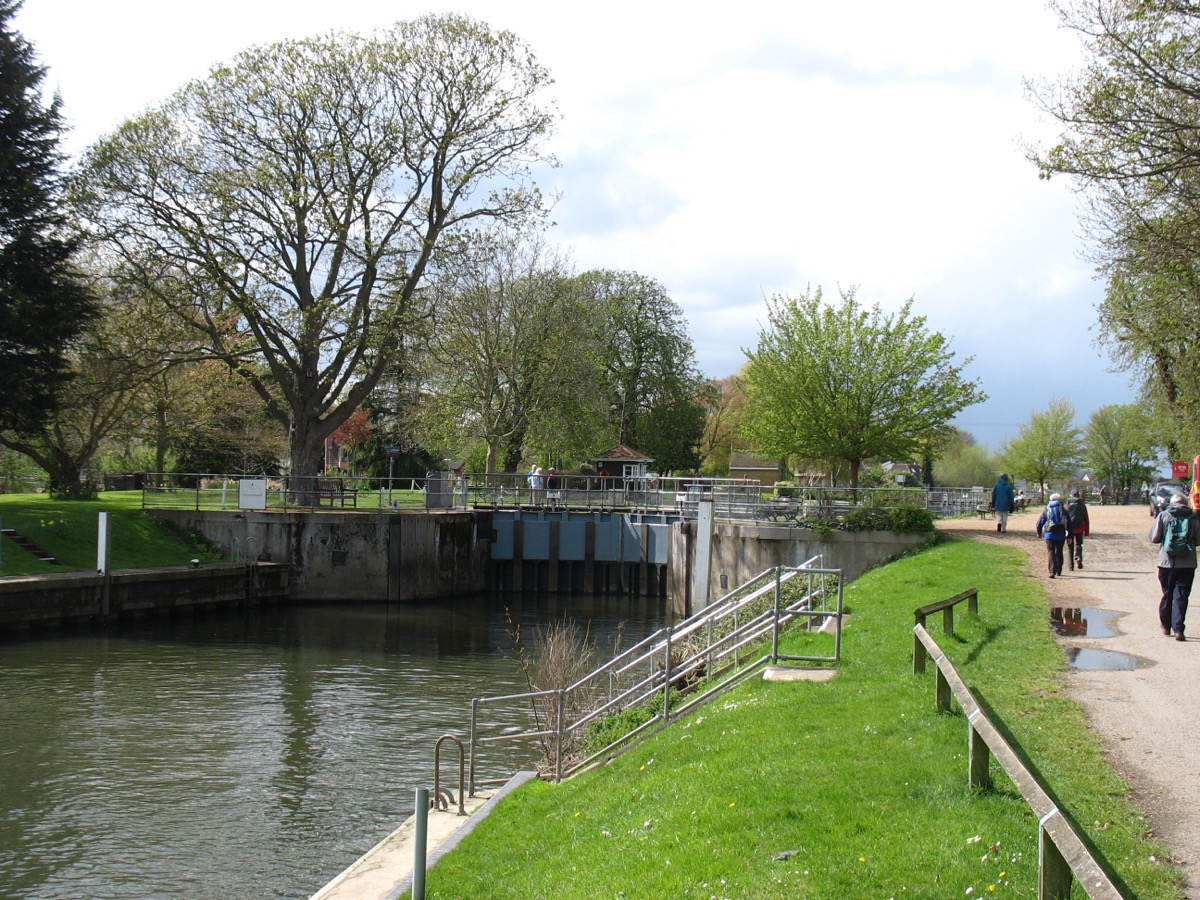
Penton Hook Lock is between Bell Weir and Chertsey locks, downstream of Staines. Plan your public walking route using the official Thames Path map. The postcode in this guide locates the lock; check parking and the final approach separately.
Penton Hook Island is closed to the public. The Environment Agency reports closure since February 2025 because of ash dieback and continuing tree work. Check the island project update before travelling. This island closure is separate from lock navigation restrictions.
Island access: current check
Checked 4 October 2026: the Environment Agency still reports the island closed following tree-safety assessments, principally involving ash dieback. Its project update describes contractor-access and tree-management work. Do not use older picnic or fishing descriptions as confirmation that the island is open.
Official island update. Check navigation notices independently; the island closure does not itself describe whether boats can pass through the lock.
EXPLORE THE THAMES
Penton Hook Marina and the wildlife island
Penton Hook Marina lists 575 berths within an 80-acre site. Its operator describes it as Britain’s largest inland marina. Check marina services and visitor berthing directly with MDL.
The Environment Agency manages Penton Hook Island. Our original account records herons, water vole, a fish spawning channel and a picnic area. Those features remain part of its local story, but the picnic area and island should not be treated as accessible while the closure remains in force.
EXPLORE THE THAMES
The bend in the river and the 1815 lock
Penton Hook was the furthest upstream, or “highest”, Thames lock built by the Corporation of London.
In the 1700s, there was no lock here. When the river flowed high and fast, the water rushed against the outside of the bend in the river and burst its banks. This caused many problems for boaters, barges and local residents.
The Corporation built a timber pound lock in 1815 to improve passage around this difficult bend. Its construction addressed the problems of the old river course; it did not remove all future flood risk.
The lock was rebuilt in 1909 and converted to hydraulic operation in 1965. The original guide links the removal of heavy manual oak beams with modernisation; the borough’s account places removal of balance beams during the 1909 rebuild.
A crossing for cattle, too
Spelthorne Borough Council records that, after the lock opened in 1815, the farmer retained grazing rights on the Hook and took cattle across the gates or through the river. It also records a six-week interruption during the 1909 rebuilding. These are historical details, not present-day access arrangements.
Research source: Spelthorne Borough Council. Checked 4 October 2026.
EXPLORE THE THAMES
Wildlife around Penton Hook
The following wildlife details are retained from our earlier local account, not a current survey or a guarantee of sightings.
A great range of birdlife congregates at Penton Hook, with its marina, wildlife island and surrounding countryside. There are kingfishers, grebes, geese and ducks, and sometimes large flocks of parakeets, continuing to spread along the region's waterways.
ON THE WATER
Boating through Penton Hook Lock
Bell Weir Lock is 4.57 km (2.84 miles) upstream. The next lock downstream is Chertsey Lock, 3.13 km (1.95 miles) away by river.
Published lock dimensions
- Length
- 81.28 m
- Width
- 7.56 m
- Fall
- 1.22 m
- Upper sill depth
- 2.74 m
- Lower sill depth
- 2.56 m
Source: Environment Agency distances and measurements. Published dimensions and sill depths do not guarantee navigable clearance. Check water levels, the full guidance and current restrictions.
Consult the lock keeper service and follow the instructions displayed at the lock.
Neighbouring reaches: cruising estimates
| Reach | km / miles | EA estimate |
|---|---|---|
| Bell Weir → Penton Hook | 4.57 / 2.84 | 35 minutes |
| Penton Hook → Chertsey | 3.13 / 1.95 | 24 minutes |
The Environment Agency estimates assume 8 km/h. Add waiting and lock-passage time; conditions can lengthen journeys. These are river distances, not walking distances.
Facilities at Penton Hook Lock
- toilet
- drinking water tap (for portable containers only)
- refuse disposal
Checked 4 October 2026 against the Environment Agency facilities guide. Availability can change; check the official guide and signs on site.
BEFORE YOU SET OFF
River conditions at Penton Hook Lock
Check stream warnings and navigation closures separately. A lack of stream warnings does not confirm that a lock is open.
For the latest information, check the official river conditions service below.
Questions about Penton Hook Lock
Is Penton Hook Island open?
The Environment Agency currently reports the island closed because of ash dieback and tree work. Check its project update for any reopening announcement.
Where is Penton Hook Lock?
It is downstream of Staines, between Bell Weir and Chertsey locks.
How large is Penton Hook Marina?
MDL lists 575 berths in an 80-acre site. Contact the marina for current visitor availability.
About this guide
Published by The River Thames Guide. Research additions, measurements and facilities checked 4 October 2026. Sources are linked beside new material; earlier local accounts are retained where identified. Check changing access and navigation arrangements before travelling.
Contains public sector information licensed under the Open Government Licence v3.0. New research is written in original wording; no third-party archive images or maps have been copied. Existing photograph credits and licences are retained.


