 The River Thames Guide
EXPLORE THE THAMES
Visiting Benson Lock and the weir walkway
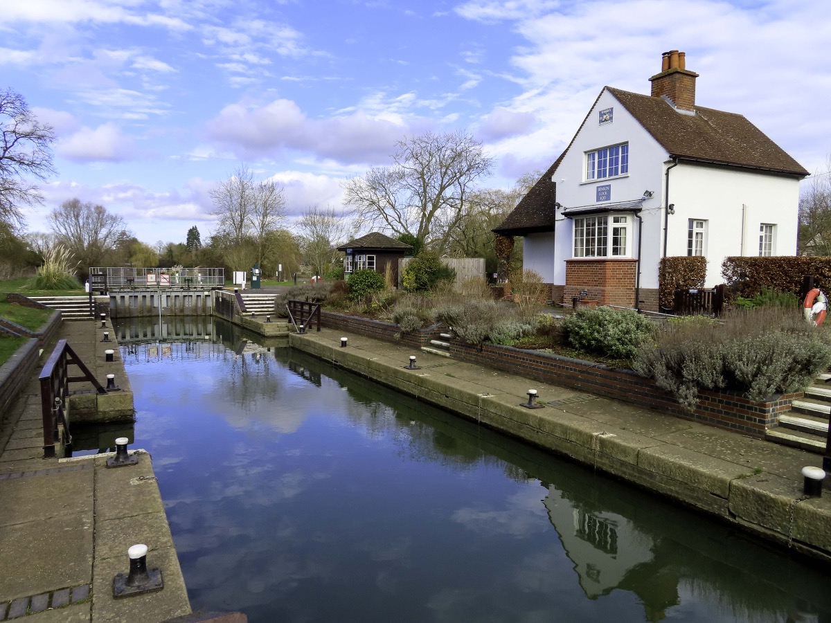
Benson Lock is at Preston Crowmarsh, beside Benson in Oxfordshire. The lock postcode is OX10 6SL. Use the official Thames Path map to plan your walking route and check local parking arrangements.
Benson Weir walkway update
The Environment Agency’s 2026 project announcement set the rebuilt walkway’s reopening for 1 April 2026, after a closure that began in November 2022. The new walkway is wider and the works include a fish and eel pass.
Some older official facilities pages still carry a closure notice. Check the latest project information and signs on site before relying on the crossing.
The original guide records an earlier ferry, which ceased when the weir walkway and lock gates became available to pedestrians.
Rechecked 4 October 2026: the EA project page specifies a 1.5 m-wide rebuilt walkway, replacing the former 0.9 m crossing. Its reopening announcement differs from the older closure text still present in the general facilities list; use the project update and on-site signs for the crossing.
EXPLORE THE THAMES
Benson to Cleeve: the longest reach between Thames locks
The Environment Agency lists 10.46 km (6.50 miles) between Benson and Cleeve Lock. This is the longest reach between neighbouring locks on the non-tidal Thames.
These are river distances, not the length of a walking route. Plan refreshments, daylight and the return journey before setting out.
EXPLORE THE THAMES
Benson Lock history
Records of a mill and weir here go back to the 1300s. The first timber pound lock followed in 1788, with a stone replacement in 1870.
Conversion to hydraulic operation in 1966 removed the heavy oak beams previously used to work the gates.
The lock house
The present lock house dates from 1913, replacing one documented in the mid-1800s. Our original guide quotes The Times in August 1865 describing Benson Lock House as “deserted, and shut up”.
Benson and Bensington
The village’s older name, Bensington, appears in the story recorded by the Anglo-Saxon Chronicle for AD 571. The earlier guide notes the use of Bensington on the parish church name board, linking the modern village with that long history.
Making room for towing horses
Building the 1788 lock also changed the riverbank. Thacker records the clearance of 160 willow and ash trees for the horse towpath: navigation depended on land beside the water as well as the chamber itself.
Research source: F. S. Thacker, The Thames Highway: Benson. Checked 4 October 2026.
EXPLORE THE THAMES
Wildlife at Benson Lock
These wildlife details come from our earlier local account, not a current survey or a guarantee of sightings.
Kingfishers, red kites and owls feature in the lock’s local wildlife account. Anglers have also reported large pike in this reach.
The surrounding riverbanks reward a quiet pause, but keep the lock gates and operating areas clear for people managing boats.
ON THE WATER
Boating through Benson Lock
Day's Lock is 6.37 km (3.96 miles) upstream. The next lock downstream is Cleeve Lock, 10.46 km (6.50 miles) away by river.
Published lock dimensions
- Length
- 40.56 m
- Width
- 5.46 m
- Fall
- 1.87 m
- Upper sill depth
- 2.23 m
- Lower sill depth
- 2.13 m
Source: Environment Agency distances and measurements. Published dimensions and sill depths do not guarantee navigable clearance. Check water levels, the full guidance and current restrictions.
Consult the lock keeper service and follow the instructions displayed at the lock.
Neighbouring reaches: cruising estimates
| Reach | km / miles | EA estimate |
|---|---|---|
| Day’s → Benson | 6.37 / 3.96 | 48 minutes |
| Benson → Cleeve | 10.46 / 6.50 | 79 minutes |
The Environment Agency estimates assume 8 km/h. Add waiting and lock-passage time; conditions can lengthen journeys. These are river distances, not walking distances.
Facilities at Benson Lock
- card and contactless payments
- drinking water tap (for portable containers only)
- electric charging point
Checked 4 October 2026 against the Environment Agency facilities guide. Availability can change; check the official guide and signs on site.
Separate navigation hazards
Checked 4 October 2026: the Environment Agency still lists a shoal below Benson’s tail gates and a submerged vessel opposite Rush Court Care Home in Benson reach. Consult the official positions and instructions before travelling. A walkway reopening does not clear these boating hazards.
BEFORE YOU SET OFF
River conditions at Benson Lock
Check stream warnings and navigation closures separately. A lack of stream warnings does not confirm that a lock is open.
For the latest information, check the official river conditions service below.
Questions about Benson Lock
Where is Benson Lock?
It is beside Benson and Preston Crowmarsh, between Day’s and Cleeve locks. Its postcode is OX10 6SL.
How far is Benson Lock from Cleeve Lock?
The published river distance is 10.46 km, or 6.50 miles—the longest reach between neighbouring locks on the non-tidal Thames.
Has the Benson Weir walkway reopened?
The Environment Agency’s 2026 project update announced reopening for 1 April 2026. Older pages may still show a closure; check current project information and signs before travelling.
About this guide
Published by The River Thames Guide. Research additions, measurements and facilities checked 4 October 2026. Sources are linked beside new material; earlier local accounts are retained where identified. Check changing access and navigation arrangements before travelling.
Contains public sector information licensed under the Open Government Licence v3.0. New research is written in original wording; no third-party archive images or maps have been copied. Existing photograph credits and licences are retained.


