 The River Thames Guide
EXPLORE THE THAMES
Visiting Day’s Lock and Little Wittenham
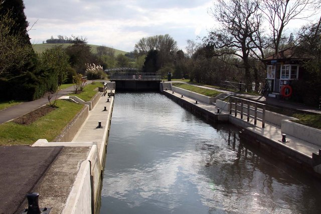
Day’s Lock is near Little Wittenham in Oxfordshire. Its postcode is OX14 4RB. Plan the public walking approach rather than assuming that the postcode leads to a visitor car park.
For Thames walks, use the official Thames Path map. To explore Little Wittenham Wood and the wider landscape around Wittenham Clumps, check Earth Trust’s visitor information for access, parking and current arrangements.
EXPLORE THE THAMES
Day’s Lock and the World Poohsticks Championships
The World Poohsticks Championships began at Day’s Lock. Inspired by A. A. Milne’s Winnie-the-Pooh stories, competitors drop marked sticks into the river and watch to see which reaches the finish first.
The organiser’s history identifies Lynn David, the local lock keeper, with the early event at Little Wittenham and its fundraising for the RNLI by 1984. Our original account recalls hundreds of spectators and teams travelling from across the globe.
The championships are no longer held here every year. The organiser advertised the 24 May 2026 event at Sandford Lock, with Abingdon Rotary now running it. Use the official Poohsticks website for future dates and venues.
EXPLORE THE THAMES
The Day family, Burcot and Thames navigation
The lock takes its name from the Day family, described in the original guide as Catholic yeomen living locally from the 1600s. The site also has a long association with gauging river flow.
Nearby Burcot gives its name to the Oxford-Burcot Commission, established under James I in 1605. Its early seventeenth-century navigation improvements brought some of the first pound locks to this part of the Thames; accounts span the 1620s and 1630s.
At Day’s itself, a flash lock was recorded in the 1500s. The Thames Navigation Commissioners built the first pound lock here in 1789.
A bell for the keeper
Thacker dates the lock’s opening to 25 June 1789. In May 1882 a bell push was installed to summon the keeper: a small glimpse of how boats requested passage in the nineteenth century.
Research source: F. S. Thacker, The Thames Highway: Days. Checked 4 October 2026.
EXPLORE THE THAMES
The River Thame and the story of King Cynegils
The River Thame joins the Thames roughly a mile downstream of Day’s Lock. The two similar names refer to separate rivers.
Local tradition associates the confluence and the Dorchester area with the baptism of King Cynegils of Wessex in 635, an important episode in the Christian history of Wessex. The precise riverside location should be treated as tradition, rather than a confirmed spot.
The earlier guide describes the Thame as suitable only for small boats and canoes. That historical description is not confirmation of present-day navigation rights, clearance or safe conditions; check the proposed route and access before entering a tributary.
EXPLORE THE THAMES
Little Wittenham wildlife
These wildlife details come from our earlier local account, not a current survey or a guarantee of sightings.
The nearby Little Wittenham Nature Reserve includes habitats recognised as a Site of Special Scientific Interest (SSSI). Earth Trust’s woodland management information also highlights the importance of the area for amphibians, including great crested newts.
The original wildlife account records skylark, grey partridge and song thrush, together with badgers, bats, shrews, muntjac and roe deer.
It also lists stoat, weasel, brown hare, bank vole and field vole. These are local records rather than a promise of sightings. Follow reserve paths and keep dogs under control around wildlife.
ON THE WATER
Boating through Day's Lock
Clifton Lock is 4.80 km (2.98 miles) upstream. The next lock downstream is Benson Lock, 6.37 km (3.96 miles) away by river.
Published lock dimensions
- Length
- 46.93 m
- Width
- 6.45 m
- Fall
- 1.58 m
- Upper sill depth
- 2.26 m
- Lower sill depth
- 1.93 m
Source: Environment Agency distances and measurements. Published dimensions and sill depths do not guarantee navigable clearance. Check water levels, the full guidance and current restrictions.
Consult the lock keeper service and follow the instructions displayed at the lock.
Neighbouring reaches: cruising estimates
| Reach | km / miles | EA estimate |
|---|---|---|
| Clifton → Day’s | 4.80 / 2.98 | 36 minutes |
| Day’s → Benson | 6.37 / 3.96 | 48 minutes |
The Environment Agency estimates assume 8 km/h. Add waiting and lock-passage time; conditions can lengthen journeys. These are river distances, not walking distances.
Facilities at Day's Lock
- card and contactless payments
- chemical toilet disposal
- refuse disposal
- drinking water tap (for portable containers only)
Checked 4 October 2026 against the Environment Agency facilities guide. Availability can change; check the official guide and signs on site.
BEFORE YOU SET OFF
River conditions at Day's Lock
Check stream warnings and navigation closures separately. A lack of stream warnings does not confirm that a lock is open.
For the latest information, check the official river conditions service below.
Questions about Day's Lock
Where is Day’s Lock?
It is near Little Wittenham in Oxfordshire, between Clifton and Benson locks. The postcode is OX14 4RB.
Are the World Poohsticks Championships still held at Day’s Lock?
The event began here, but the organiser advertised its 2026 championships at Sandford Lock. Check the official Poohsticks website for future dates and venues.
Where does the River Thame join the Thames?
The confluence is near Dorchester, roughly a mile downstream of Day’s Lock.
About this guide
Published by The River Thames Guide. Research additions, measurements and facilities checked 4 October 2026. Sources are linked beside new material; earlier local accounts are retained where identified. Check changing access and navigation arrangements before travelling.
Contains public sector information licensed under the Open Government Licence v3.0. New research is written in original wording; no third-party archive images or maps have been copied. Existing photograph credits and licences are retained.


