 The River Thames Guide
EXPLORE THE THAMES
Visiting Eynsham Lock and Swinford Bridge
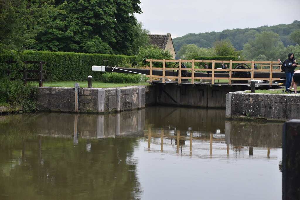
Eynsham Lock makes a useful stopping point for a Thames Path walk around Swinford and Eynsham. The lock postcode is OX29 4BY. Check public parking and rights of way separately from the lock’s postal address.
Plan river crossings and your return route using the official Thames Path map. Swinford is a working road bridge, so choose your route with care and follow local signs.
The Environment Agency’s facilities list below includes an accessible toilet, water supplies and waste-disposal facilities. Availability can change; use the current official guide before relying on them.
A service stop on the upper Thames
Eynsham’s EA listing includes bulk water, pump-out and waste disposal, as well as a shower and accessible toilet. Confirm availability before planning a service stop; the toilet listing does not establish step-free access along your whole route.
EA facilities guide, checked 5 October 2026.
EXPLORE THE THAMES
Swinford Toll Bridge and Eynsham village
Swinford Toll Bridge is a landmark of Georgian river engineering, associated in our original guide with 1769 and the era of stage coaches, highwaymen and turnpikes. The Historic England listing dates its construction to 1767 for the Earl of Abingdon; historical accounts distinguish construction and opening dates.
The name Swinford recalls a “swine ford”, an old crossing for pigs. Our guide pairs Swinford with Whitchurch as the Thames’s surviving toll crossings; check the bridge operator’s current arrangements before travelling.
Eynsham is an ancient settlement. The Anglo-Saxon Chronicle entry for 571 AD associates Cuthwolf and the battle at Bedcanford with the capture of four settlements: Limbury, Aylesbury, Benson and Eynsham. This early reference is part of the village’s historical identity, rather than proof of a ranking as Britain’s oldest village.
EXPLORE THE THAMES
The history of Eynsham Lock
The present pound lock was built in 1928 as part of the Thames Conservancy’s improvements to navigation towards Lechlade. Before it, a flash weir by the toll bridge served the river; its history reaches back to medieval times and Eynsham Abbey.
The published fall is just 0.84 metres (about 2 ft 9 in), among the shallowest on the Thames. Our earlier account called it the fourth shallowest and quoted at least 135 million litres passing the lock and weir each day. That flow figure is a historical description, not a current river-flow reading; actual flow varies.
Before the pound lock
Thacker records a boat slide ordered at Eynsham’s weir in 1890. Small-boat passage was being improved decades before the present pound lock.
Research source: F. S. Thacker, The Thames Highway: Eynsham. Checked 5 October 2026.
EXPLORE THE THAMES
Wildlife around Eynsham Lock
These wildlife details come from our earlier local account, not a current survey or a guarantee of sightings.
Our local account records otters, grebes, terns, buzzards, kestrels and sparrowhawks, with a possible egret sighting. The earlier wording “golden crested grebes” is not a recognised species name, so the bird is described here simply as a grebe.
Watch from public riverside paths and allow time to pause. Sightings depend on season and conditions, particularly for elusive otters.
ON THE WATER
Boating through Eynsham Lock
Pinkhill Lock is 2.38 km (1.48 miles) upstream. The next lock downstream is King's Lock, 4.37 km (2.71 miles) away by river.
Published lock dimensions
- Length
- 34.51 m
- Width
- 4.97 m
- Fall
- 0.84 m
- Upper sill depth
- 1.65 m
- Lower sill depth
- 1.72 m
Source: Environment Agency distances and measurements. Published dimensions and sill depths do not guarantee navigable clearance. Check water levels, the full guidance and current restrictions.
Consult the lock keeper service and follow the instructions displayed at the lock.
Neighbouring reaches: cruising estimates
| Reach | km / miles | EA estimate |
|---|---|---|
| Pinkhill → Eynsham | 2.38 / 1.48 | 18 minutes |
| Eynsham → King’s | 4.37 / 2.71 | 33 minutes |
The Environment Agency estimates assume 8 km/h. Add waiting and lock-passage time; conditions can lengthen journeys. These are river distances, not walking distances.
Facilities at Eynsham Lock
- card and contactless payments
- toilet (accessible)
- shower
- drinking water tap (for portable containers only)
- bulk supply water point
- chemical toilet disposal
- sewage pump-out
- recycling facilities
- refuse disposal
Checked 5 October 2026 against the Environment Agency facilities guide. Availability can change; check the official guide and signs on site.
Dry-weather passage restrictions
Checked 5 October 2026: the EA still lists restrictions from St John’s to Osney, covering this lock. Passages during keeper hours are limited to one movement each way per half-hour. Overnight closures run from 30 minutes before duty ends until 30 minutes after duty starts the next day. Check current hours and the full notice when planning your arrival.
EA dry-weather navigation notice; arrangements remain subject to review.
BEFORE YOU SET OFF
River conditions at Eynsham Lock
Check stream warnings and navigation closures separately. A lack of stream warnings does not confirm that a lock is open.
For the latest information, check the official river conditions service below.
Questions about Eynsham Lock
Where is Eynsham Lock?
Eynsham Lock is at Swinford on the Thames west of Oxford, between Pinkhill and King’s Lock. Its postcode is OX29 4BY.
How deep is the drop at Eynsham Lock?
The Environment Agency publishes a lock fall of 0.84 metres. This is the change in water level, not the available depth for a boat.
When was Eynsham Lock built?
The present pound lock dates from 1928. A much older flash weir preceded it near Swinford Bridge.
About this guide
Published by The River Thames Guide. Research additions, measurements and facilities checked 5 October 2026. Sources are linked beside new material; earlier local accounts are retained where identified. Check changing access and navigation arrangements before travelling.
Contains public sector information licensed under the Open Government Licence v3.0. New research is written in original wording; no third-party archive images or maps have been copied. Existing photograph credits and licences are retained.


