 The River Thames Guide
EXPLORE THE THAMES
Visiting Pinkhill Lock and Farmoor Reservoir
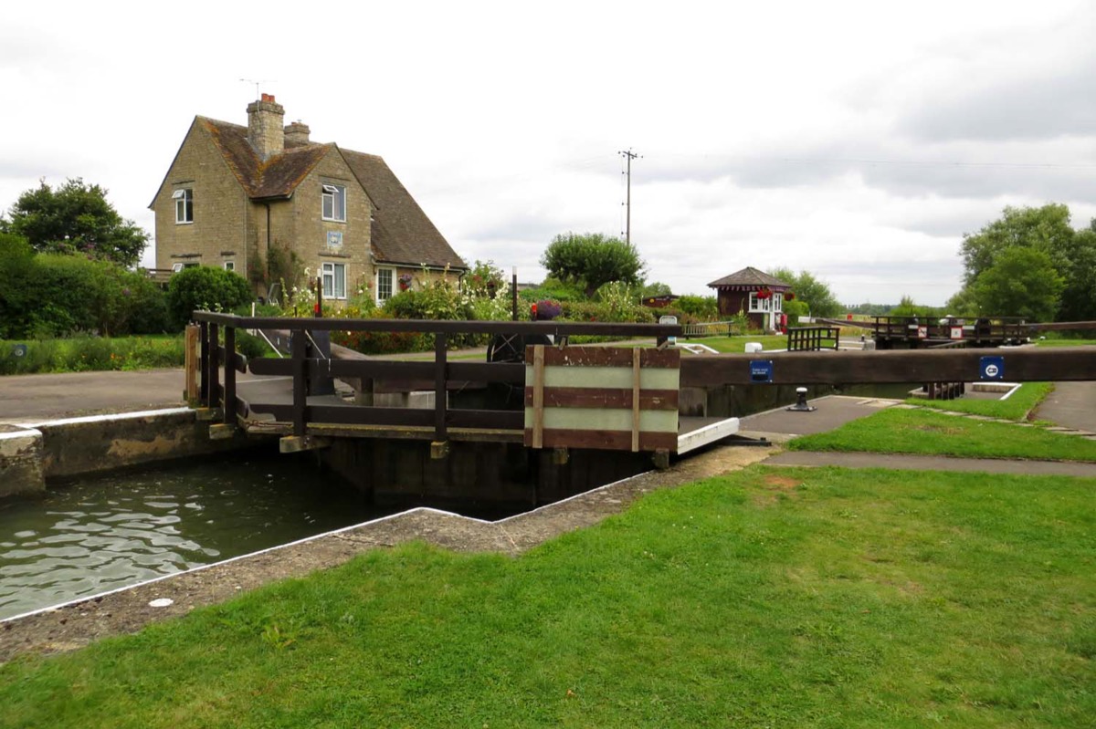
Pinkhill Lock sits beside the Farmoor reservoir landscape on the upper Thames. The lock postcode is OX29 4JH. For a visit combining the river and reservoirs, use Thames Water’s Farmoor visitor guide for current entry, parking and access arrangements.
Thames Water lists a fishery, nature reserves, a café and an easy-access route around the reservoir suitable for buggies and wheelchairs. This describes the reservoir route; check separately before assuming that a route to the lock or along the Thames Path has the same access standard.
Use the official Thames Path map to plan river crossings and return routes. The boating distances below are measured along the river and are not walking distances.
EXPLORE THE THAMES
Pinkhill Lock and its changing landscape
A stone manual-beam pound lock was first built here in 1791, followed by later repairs and rebuilds. Its traditional form contrasts with the much newer reservoir landscape beside it.
Our original guide recalls flat fields giving way to two large reservoirs, with excavated spoil forming the hill beside the lock. The development changed the outlook while also creating new habitats around Farmoor.
From paddle and rymer to radial weir
The local history records a paddle and rymer weir replaced in 1932 by a Buck weir, whose gates rose vertically between upright runners. An electrically operated radial weir followed in 1998.
The people behind the first lock
Thacker identifies Nock as the builder and Daniel Harris, Oxford’s gaoler, as engineer of the 1791 lock. The project connected this rural site with Oxford’s navigation administration.
Research source: F. S. Thacker, The Thames Highway: Pinkhill. Checked 6 October 2026.
EXPLORE THE THAMES
Farmoor’s wetland nature reserves
The three wetland reserves named in our original guide are Buckthorn Meadow, Pinkhill Meadow and Shrike Meadow. They were developed through work by the Environment Agency and Thames Water, helping give the reservoir margins their wildlife interest.
The earlier account quoted a combined creation cost of £30,000; this is a historical figure, not a current budget or visitor charge. Thames Water’s current visitor page confirms three nature reserves at Farmoor. Follow its access guidance and local signs when exploring.
The reservoirs also attract water sports enthusiasts, walkers, anglers and birdwatchers. Check activity-specific arrangements with the relevant operator.
EXPLORE THE THAMES
Wildlife at Pinkhill Lock
These wildlife details come from our earlier local account, not a current survey or a guarantee of sightings.
Our local wildlife record includes grass snakes, barn owls, kestrels, buzzards, red kites and otters. The surrounding wetlands and reservoir margins add to the variety of habitats beside the river.
Wildlife sightings are seasonal and unpredictable. Watch from the permitted paths and birdwatching areas, keeping a distance from nesting birds and riverbank cover.
ON THE WATER
Boating through Pinkhill Lock
Northmoor Lock is 6.21 km (3.86 miles) upstream. The next lock downstream is Eynsham Lock, 2.38 km (1.48 miles) away by river.
Published lock dimensions
- Length
- 34.59 m
- Width
- 4.90 m
- Fall
- 1.05 m
- Upper sill depth
- 1.67 m
- Lower sill depth
- 1.62 m
Source: Environment Agency distances and measurements. Published dimensions and sill depths do not guarantee navigable clearance. Check water levels, the full guidance and current restrictions.
Consult the lock keeper service and follow the instructions displayed at the lock.
Neighbouring reaches: cruising estimates
| Reach | km / miles | EA estimate |
|---|---|---|
| Northmoor → Pinkhill | 6.21 / 3.86 | 47 minutes |
| Pinkhill → Eynsham | 2.38 / 1.48 | 18 minutes |
The Environment Agency estimates assume 8 km/h. Add waiting and lock-passage time; conditions can lengthen journeys. These are river distances, not walking distances.
Facilities at Pinkhill Lock
- card and contactless payments
- toilet
- shower – currently closed
- drinking water tap (for portable containers only)
Checked 6 October 2026 against the Environment Agency facilities guide. Availability can change; check the official guide and signs on site.
Dry-weather passage restrictions
Checked 6 October 2026: the EA still lists restrictions from St John’s to Osney, covering this lock. Passages during keeper hours are limited to one movement each way per half-hour. Overnight closures run from 30 minutes before duty ends until 30 minutes after duty starts the next day. Check current hours and the full notice when planning your arrival.
EA dry-weather navigation notice; arrangements remain subject to review.
BEFORE YOU SET OFF
River conditions at Pinkhill Lock
Check stream warnings and navigation closures separately. A lack of stream warnings does not confirm that a lock is open.
For the latest information, check the official river conditions service below.
Questions about Pinkhill Lock
Is Pinkhill Lock near Farmoor Reservoir?
Yes. Pinkhill Lock is beside the Farmoor reservoir landscape on the upper Thames. Use Thames Water’s visitor guide for current reservoir access and parking arrangements.
Is the walk to Pinkhill Lock wheelchair accessible?
Thames Water describes an accessible route around the reservoir, but that does not confirm every route to the lock. Check your exact route and current access information before travelling.
Which nature reserves are near Pinkhill Lock?
The three reserves named in our guide are Buckthorn Meadow, Pinkhill Meadow and Shrike Meadow, around Farmoor Reservoir.
About this guide
Published by The River Thames Guide. Research additions, measurements and facilities checked 6 October 2026. Sources are linked beside new material; earlier local accounts are retained where identified. Check changing access and navigation arrangements before travelling. Historic construction costs are labelled as historical; reservoir access advice is kept separate from access to the lock.
Contains public sector information licensed under the Open Government Licence v3.0. New research is written in original wording; no third-party archive images or maps have been copied. Existing photograph credits and licences are retained.


