 The River Thames Guide
EXPLORE THE THAMES
Visiting Northmoor Lock and the Thames Path
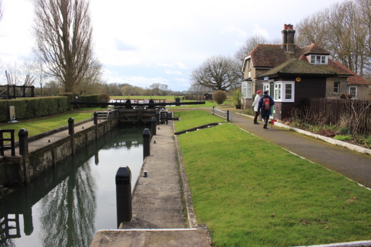
Northmoor Lock is a quiet stop on the upper Thames near Appleton. The Environment Agency identifies its location near Appleton; use the lock’s OX13 5JP postcode and official grid reference to plan your approach.
The Thames Path route map helps with walking routes, crossings and diversions. Check public rights of way and parking before travelling. The lock address does not establish public vehicle access, and riverside paths can become muddy or flooded.
The Ferryman and Bablock Hythe
The nearby riverside area at Bablock Hythe is associated with The Ferryman Inn. Check the pub’s own website for current food, accommodation and opening arrangements.
Our earlier guide recalls an occasional ferry here and a local tradition of a crossing stretching back about 1,000 years. This is part of the area’s history; do not plan a river crossing on the assumption that a ferry is operating today.
EXPLORE THE THAMES
The history of Northmoor Lock
Northmoor’s pound lock was built in 1896, replacing the earlier flash-weir arrangements associated with Hart’s Weir and Ark Weir. Its heavy wooden balance beams reflect the traditional way of operating lock gates on the upper Thames.
The original guide said locks were introduced to Britain in the 1800s. Pound locks were in use much earlier; 1896 is the date of this particular lock, not the beginning of British lock navigation.
Our local account records that income from water abstraction helped pay for Northmoor Lock, with the intention of encouraging freight onto the Thames. It belongs to the story of commercial river transport and its competition with other waterways and the railways.
Opening and the first keeper
Thacker dates Northmoor’s opening to January 1896 and the appointment of its first keeper, J. Basson of Reading, to the following month.
Research source: F. S. Thacker, The Thames Highway: Northmoor. Checked 6 October 2026.
EXPLORE THE THAMES
Northmoor’s paddle and rymer weir
The paddle and rymer system is a distinctive part of Northmoor’s heritage. In this traditional form of water control, removable paddles and upright rymers regulate flow through the weir.
The earlier guide described Northmoor as one of only three surviving examples of its type. The number and condition of these structures have changed, so that old count should not be treated as a current inventory.
Appleton with Eaton Parish Council’s heritage account (PDF) describes the campaign to retain Northmoor’s weir and work on lighter paddles and rymers. View the structure from permitted riverside paths or the river; operational parts of a weir are not visitor walkways.
EXPLORE THE THAMES
Wildlife around Northmoor Lock
These wildlife details come from our earlier local account, not a current survey or a guarantee of sightings.
The original guide records kestrels, lapwings, buzzards, red kites, woodpeckers and kingfishers, as well as occasional otters. This varied wildlife is part of the natural heritage of the lock site managed by the Environment Agency.
Watch quietly from public paths and allow space for wildlife. Sightings vary with the season, weather and time of day.
ON THE WATER
Boating through Northmoor Lock
Shifford Lock is 7.63 km (4.74 miles) upstream. The next lock downstream is Pinkhill Lock, 6.21 km (3.86 miles) away by river.
Published lock dimensions
- Length
- 34.59 m
- Width
- 4.59 m
- Fall
- 1.24 m
- Upper sill depth
- 1.65 m
- Lower sill depth
- 1.44 m
Source: Environment Agency distances and measurements. Published dimensions and sill depths do not guarantee navigable clearance. Check water levels, the full guidance and current restrictions.
Consult the lock keeper service and follow the instructions displayed at the lock.
Neighbouring reaches: cruising estimates
| Reach | km / miles | EA estimate |
|---|---|---|
| Shifford → Northmoor | 7.63 / 4.74 | 58 minutes |
| Northmoor → Pinkhill | 6.21 / 3.86 | 47 minutes |
The Environment Agency estimates assume 8 km/h. Add waiting and lock-passage time; conditions can lengthen journeys. These are river distances, not walking distances.
Facilities at Northmoor Lock
- card and contactless payments
- drinking water tap (for portable containers only)
Checked 6 October 2026 against the Environment Agency facilities guide. Availability can change; check the official guide and signs on site.
Dry-weather passage restrictions
Checked 6 October 2026: the EA still lists restrictions from St John’s to Osney, covering this lock. Passages during keeper hours are limited to one movement each way per half-hour. Overnight closures run from 30 minutes before duty ends until 30 minutes after duty starts the next day. Check current hours and the full notice when planning your arrival.
EA dry-weather navigation notice; arrangements remain subject to review.
BEFORE YOU SET OFF
River conditions at Northmoor Lock
Check stream warnings and navigation closures separately. A lack of stream warnings does not confirm that a lock is open.
For the latest information, check the official river conditions service below.
Questions about Northmoor Lock
Where is Northmoor Lock?
Northmoor Lock is on the Thames near Appleton in Oxfordshire, between Shifford and Pinkhill locks. The lock postcode is OX13 5JP.
What is a paddle and rymer weir?
It is a traditional weir using removable paddles and upright rymers to regulate water flow. Northmoor’s structure is an important part of its local river heritage.
Can I use a ferry at Bablock Hythe?
The earlier guide describes a historic ferry service, but this is not confirmation of a current crossing. Plan your route using established public crossings and current local information.
About this guide
Published by The River Thames Guide. Research additions, measurements and facilities checked 6 October 2026. Sources are linked beside new material; earlier local accounts are retained where identified. Check changing access and navigation arrangements before travelling. The location and lock chronology have been clarified; the old ferry and surviving-weir count are treated as historical information.
Contains public sector information licensed under the Open Government Licence v3.0. New research is written in original wording; no third-party archive images or maps have been copied. Existing photograph credits and licences are retained.


