 The River Thames Guide
EXPLORE THE THAMES
Visiting Shifford Lock and Chimney Meadows
Shifford Lock is a countryside stop on the upper Thames, close to Chimney Meadows, managed by the Berkshire, Buckinghamshire and Oxfordshire Wildlife Trust (BBOWT). BBOWT currently lists the reserve as 308 hectares, updating the original guide’s broad description of a 1,000-acre landscape.
Start with BBOWT’s Chimney Meadows and Duxford Old River guide. Access to some sensitive areas is limited to protect wildlife. Follow marked paths and seasonal signs, and do not assume that all meadowland is open to visitors.
Use the Thames Path route map to plan a walk and check current diversions. The lock postcode is OX18 2EJ; it identifies the site, not a public parking guarantee.
Route notice: BBOWT currently reports Ten Foot Bridge closed until further notice. This affects connections from Duxford and Buckland to the Thames Path beside the reserve. Check the linked reserve guide for the latest position before planning a crossing.
The reserve has a designated BBOWT car park at its entrance; visitors are asked not to park in Chimney hamlet. Dogs must be on leads. Check the reserve map and accessibility advice when choosing a route.
EXPLORE THE THAMES
Shifford village and the history of the lock
The name Shifford has been associated with a “sheep ford”. Local tradition says that King Alfred held a parliament at Shifford in 890 AD; this is a story attached to the village, rather than a securely established event presented here as fact.
The Thames had pound locks by the seventeenth century, but Shifford’s lock is much later. Our earlier guide gives 1897 for completion; Thacker records it ready for traffic by March 1898, as explained below. It was one of the later additions to the river’s navigation system.
Shifford Lock Cut and the Duxford loop
The lock was built on dry land as part of a new channel, Shifford Lock Cut, shortening a river loop that ran south towards Duxford village. Our earlier account describes light craft and canoes using the old loop; do not treat that historical description as confirmation of present-day navigability or access.
A wooden footbridge upstream of the lock is another feature recorded in the original guide, adding to the character of the lock cut and its walking routes.
Opening dates and a river journey to church
Thacker records the first keeper’s appointment in December 1897 and readiness for traffic by March 1898. He also records free lock passes granted to Chimney tenants travelling to church by boat.
Research source: F. S. Thacker, The Thames Highway: Shifford. Checked 6 October 2026.
EXPLORE THE THAMES
Wildlife at Shifford and Chimney Meadows
These wildlife details come from our earlier local account, not a current survey or a guarantee of sightings.
The river and nearby reserve feature in our records of otters, kestrels, buzzards, owls, kingfishers, house martins and curlews. The earlier guide also reports an osprey above the lock.
These sightings describe the area’s wildlife interest; individual species may be seasonal or uncommon. Bring binoculars, remain on permitted paths and give birds and riverbank animals space.
ON THE WATER
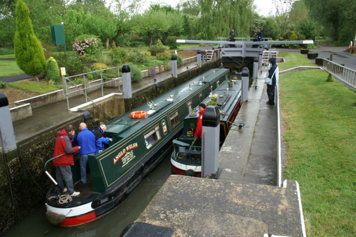
Boating through Shifford Lock
Rushey Lock is 6.92 km (4.30 miles) upstream. The next lock downstream is Northmoor Lock, 7.63 km (4.74 miles) away by river.
Published lock dimensions
- Length
- 34.64 m
- Width
- 4.59 m
- Fall
- 2.23 m
- Upper sill depth
- 1.67 m
- Lower sill depth
- 1.60 m
Source: Environment Agency distances and measurements. Published dimensions and sill depths do not guarantee navigable clearance. Check water levels, the full guidance and current restrictions.
Consult the lock keeper service and follow the instructions displayed at the lock.
Neighbouring reaches: cruising estimates
| Reach | km / miles | EA estimate |
|---|---|---|
| Rushey → Shifford | 6.92 / 4.30 | 52 minutes |
| Shifford → Northmoor | 7.63 / 4.74 | 58 minutes |
The Environment Agency estimates assume 8 km/h. Add waiting and lock-passage time; conditions can lengthen journeys. These are river distances, not walking distances.
Facilities at Shifford Lock
- toilet
- shower – currently closed
- bulk supply water point
- electric charging point
Checked 6 October 2026 against the Environment Agency facilities guide. Availability can change; check the official guide and signs on site.
Dry-weather passage restrictions
Checked 6 October 2026: the EA still lists restrictions from St John’s to Osney, covering this lock. Passages during keeper hours are limited to one movement each way per half-hour. Overnight closures run from 30 minutes before duty ends until 30 minutes after duty starts the next day. Check current hours and the full notice when planning your arrival.
EA dry-weather navigation notice; arrangements remain subject to review.
BEFORE YOU SET OFF
River conditions at Shifford Lock
Check stream warnings and navigation closures separately. A lack of stream warnings does not confirm that a lock is open.
For the latest information, check the official river conditions service below.
Questions about Shifford Lock
Is Shifford Lock near Chimney Meadows?
Yes. The lock is close to the Chimney Meadows landscape managed by BBOWT. Use the reserve’s current visitor guide for permitted routes and any access restrictions.
When was Shifford Lock built?
The guide’s earlier completion date is 1897; Thacker records readiness for traffic by March 1898. The new cut shortened the old river loop towards Duxford.
Can I plan a canoe trip around the old river loop?
The old guide records light craft using it, but conditions and access can change. Check current navigation, land-access and river-condition information before planning that route.
About this guide
Published by The River Thames Guide. Research additions, measurements and facilities checked 6 October 2026. Sources are linked beside new material; earlier local accounts are retained where identified. Check changing access and navigation arrangements before travelling. The Alfred story is identified as local tradition; historic canoe access is not presented as a current navigation assurance.
Contains public sector information licensed under the Open Government Licence v3.0. New research is written in original wording; no third-party archive images or maps have been copied. Existing photograph credits and licences are retained.


