 The River Thames Guide
EXPLORE THE THAMES
Visiting Hurley Lock and village
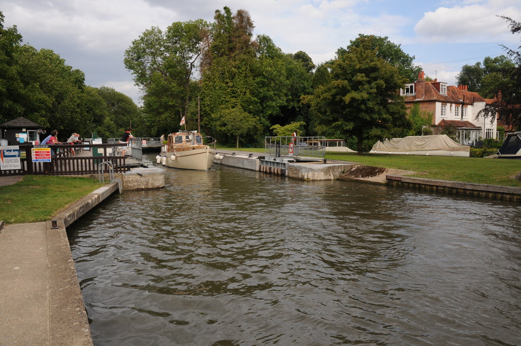
Hurley Lock lies beside the Berkshire village of Hurley, among wooded Thames islands. The lock address is Mill Lane, Hurley, SL6 5ND. Check public parking and the walking approach before travelling.
The official Thames Path map helps plan a riverside walk. If continuing towards Marlow, remember that Temple Footbridge is closed; check the Environment Agency’s bridge update and follow the signed diversion.
The earlier guide estimated 200,000 visitors a year, excluding boat traffic. That figure reflects the lock’s established popularity, rather than a current visitor count.
A short river reach is not a walking shortcut
Temple is only 1.03 km downstream by river, but that distance does not describe a walking route. For a walk towards Marlow, allow for the closed Temple Footbridge and follow the signed diversion. The facilities list also still marks Hurley’s shower as closed.
EA facilities and footbridge guidance, checked 4 October 2026.
EXPLORE THE THAMES
Hurley Regatta and kayaking at the weir
Hurley Regatta combines river competition with a village social event. Use the organiser’s website for future dates, entries and visitor arrangements.
Hurley Weir is associated with Thames Valley white-water kayaking and the Thames Weir Project. It is a specialist paddling venue, where suitability depends on the flow, gate settings and the paddler’s experience.
For a touring route, Go Paddling’s Hurley-to-Maidenhead trail offers route-planning information. Weir paddling requires a separate assessment and should not be treated as a casual extension of a riverside visit.
EXPLORE THE THAMES
Hurley village and the old river crossing
The original guide traces a ford in the area to AD 450, near the beginning of the Saxon period, and suggests a location by Harleyford Manor. This early date and precise location are retained as a local historical account.
Hurley predates the Norman Conquest. The name Herlei appears in the village’s older story, which the guide associates with the Danes.
Buildings near the river preserve links with a Benedictine monastery, mentioned in the Domesday survey of 1086.
The first keeper and the early repairs
Thacker identifies John Gould as the first toll collector in 1773 and records a small wooden keeper’s house the following year. Repairs were already needed by 1780. During rebuilding in 1785, the older flash lock was to be kept ready for barges: the change to pound-lock navigation did not immediately erase the earlier system.
Research source: Thacker’s The Thames Highway (1920), Hurley section. Checked 4 October 2026.
EXPLORE THE THAMES
Hurley’s flash lock and surviving capstan
A flash weir here was known as Newlock in the 1580s. River crews used capstans or winches to haul boats upstream against the flow released through a flash lock.
The original guide records a partly restored flash lock capstan on the riverbank, describing it as the only surviving example on the Thames. It also states that the land is not accessible to the public; do not enter private land to look for it.
The Thames Navigation Commissioners installed a pound lock of fir timber in 1773, part of a wider programme to improve river navigation.
EXPLORE THE THAMES
Wildlife around Hurley Lock
The following wildlife details are retained from our earlier local account, not a current survey or a guarantee of sightings.
The surrounding mature woodland and river support a variety of wildlife. The local account records kingfishers, herons, green and great spotted woodpeckers, red kites and buzzards.
Ring-necked parakeets and occasional muntjac deer are also mentioned. Enjoy the area from public paths and keep working lock access clear.
ON THE WATER
Boating through Hurley Lock
Hambleden Lock is 5.89 km (3.66 miles) upstream. The next lock downstream is Temple Lock, 1.03 km (0.64 miles) away by river.
Published lock dimensions
- Length
- 39.82 m
- Width
- 6.07 m
- Fall
- 1.05 m
- Upper sill depth
- 1.88 m
- Lower sill depth
- 1.88 m
Source: Environment Agency distances and measurements. Published dimensions and sill depths do not guarantee navigable clearance. Check water levels, the full guidance and current restrictions.
Consult the lock keeper service and follow the instructions displayed at the lock.
Neighbouring reaches: cruising estimates
| Reach | km / miles | EA estimate |
|---|---|---|
| Hambleden → Hurley | 5.89 / 3.66 | 45 minutes |
| Hurley → Temple | 1.03 / 0.64 | 8 minutes |
The Environment Agency estimates assume 8 km/h. Add waiting and lock-passage time; conditions can lengthen journeys. These are river distances, not walking distances.
Facilities at Hurley Lock
- card and contactless payments
- toilet (accessible)
- shower for overnight moorers and campers – currently closed
- drinking water tap (for portable containers only)
- bulk supply water point
- chemical toilet disposal
- refuse disposal
Checked 4 October 2026 against the Environment Agency facilities guide. Availability can change; check the official guide and signs on site.
BEFORE YOU SET OFF
River conditions at Hurley Lock
Check stream warnings and navigation closures separately. A lack of stream warnings does not confirm that a lock is open.
For the latest information, check the official river conditions service below.
Questions about Hurley Lock
Where is Hurley Lock?
It is at Mill Lane, Hurley, Berkshire, between Hambleden and Temple locks. The postcode is SL6 5ND.
Can I walk from Hurley towards Marlow?
Check the Thames Path route and the signed diversion around closed Temple Footbridge before setting off. Do not assume the original riverside crossing is available.
Is Hurley Weir suitable for beginner paddlers?
It is a specialist white-water venue. Flow, gate settings, equipment and experience matter; obtain current local paddling guidance rather than assuming the weir is suitable.
About this guide
Published by The River Thames Guide. Research additions, measurements and facilities checked 4 October 2026. Sources are linked beside new material; earlier local accounts are retained where identified. Check changing access and navigation arrangements before travelling.
Contains public sector information licensed under the Open Government Licence v3.0. New research is written in original wording; no third-party archive images or maps have been copied. Existing photograph credits and licences are retained.


