 The River Thames Guide
EXPLORE THE THAMES
Visiting Bray Lock
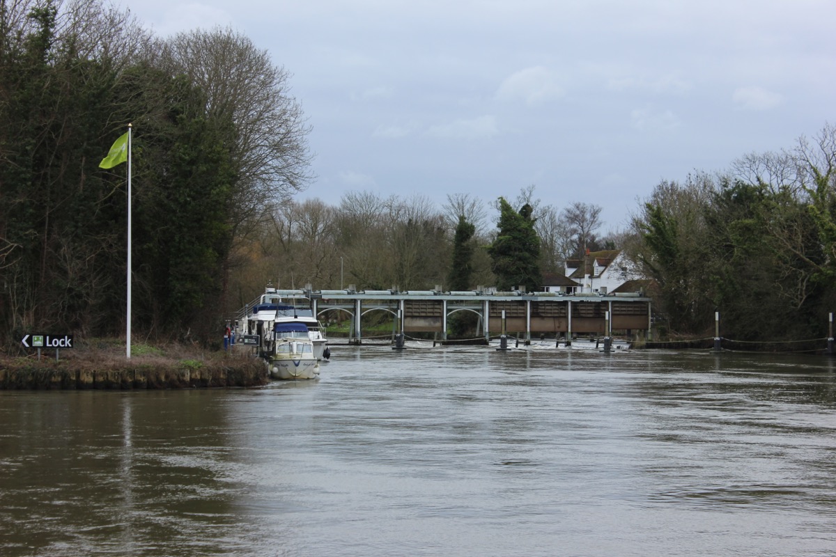
Bray Lock is on the Thames near Bray, downstream of Maidenhead. Plan your public walking route using the official Thames Path map. The postcode in this guide locates the lock; check parking and the final approach separately.
Plan the approach, not just the postcode
Use the public-path map to choose your approach to the lock. A visit to Bray village and a visit to the lock are different destinations: do not assume there is a public river crossing at the lock or access through private riverside gardens.
EXPLORE THE THAMES
Bray and the riverside reach
The reach upstream towards Boulters Lock has long been nicknamed “millionaires row” for its grand riverside homes and celebrity associations. Enjoy the views from public paths and respect private gardens.
Nearby Bray is known for The Fat Duck and The Waterside Inn. Consult each restaurant directly for bookings and opening arrangements.
THE WORKING RIVER
Bray Lock’s changing chamber
The earlier guide describes Staffordshire blue brick and an inscription, JH 1885, in the chamber. This is retained as a local observation, not a new survey. The lock’s history includes several stages of construction.
A keeper’s home before the pound
F. S. Thacker’s 1920 history records a lock house on the island in 1844, followed by the lock in 1845. His account describes an early chamber without built sides, with sides added before 1877, and places rebuilding of the lock and weir around 1885. These stages help explain why the first-lock date and the surviving brickwork need not match.
Research source: Thacker’s The Thames Highway (1920), Bray Lock section. Checked 4 October 2026.
EXPLORE THE THAMES
Wildlife around Bray Lock
The following wildlife details are retained from our earlier local account, not a current survey or a guarantee of sightings.
Bray Lock attracts a wide variety of wildlife - red kites, kingfishers, lesser spotted woodpeckers, jays along with the usual range of waterfowl. On the ground are mink, and the local account records grass snakes swimming across the river here.
ON THE WATER
Boating through Bray Lock
Boulters Lock is 3.43 km (2.13 miles) upstream. The next lock downstream is Boveney Lock, 5.10 km (3.17 miles) away by river.
Published lock dimensions
- Length
- 40.94 m
- Width
- 5.46 m
- Fall
- 1.46 m
- Upper sill depth
- 2.13 m
- Lower sill depth
- 2.13 m
Source: Environment Agency distances and measurements. Published dimensions and sill depths do not guarantee navigable clearance. Check water levels, the full guidance and current restrictions.
Consult the lock keeper service and follow the instructions displayed at the lock.
Neighbouring reaches: cruising estimates
| Reach | km / miles | EA estimate |
|---|---|---|
| Boulters → Bray | 3.43 / 2.13 | 26 minutes |
| Bray → Boveney | 5.10 / 3.17 | 39 minutes |
The Environment Agency estimates assume 8 km/h. Add waiting and lock-passage time; conditions can lengthen journeys. These are river distances, not walking distances.
Facilities at Bray Lock
- card and contactless payments
- toilet (accessible)
Checked 4 October 2026 against the Environment Agency facilities guide. Availability can change; check the official guide and signs on site.
BEFORE YOU SET OFF
River conditions at Bray Lock
Check stream warnings and navigation closures separately. A lack of stream warnings does not confirm that a lock is open.
For the latest information, check the official river conditions service below.
Questions about Bray Lock
Where is Bray Lock?
It is near Bray in Berkshire, between Boulters Lock and Boveney Lock.
What is the JH 1885 brick?
The original guide records these initials and the year on a Staffordshire blue brick in the chamber, which was rebuilt in 1885.
What restaurants are nearby?
Bray village is home to The Fat Duck and The Waterside Inn; check directly for reservations.
About this guide
Published by The River Thames Guide. Research additions, measurements and facilities checked 4 October 2026. Sources are linked beside new material; earlier local accounts are retained where identified. Check changing access and navigation arrangements before travelling.
Contains public sector information licensed under the Open Government Licence v3.0. New research is written in original wording; no third-party archive images or maps have been copied. Existing photograph credits and licences are retained.


