 The River Thames Guide
EXPLORE THE THAMES
Visiting Boulters Lock
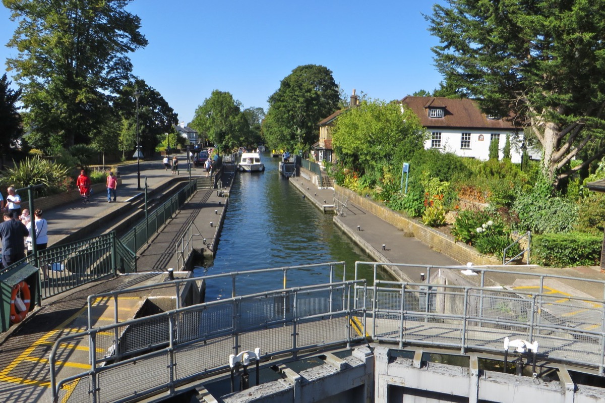
Boulters Lock is in Maidenhead beside the A4094, between Cookham and Bray locks. Plan your public walking route using the official Thames Path map. The postcode in this guide locates the lock; check parking and the final approach separately.
Ray Mill Island is next to the lock. Check the Royal Borough’s visitor information and signs for current access and facilities.
Choose a riverside outing
The borough’s December 2020 Walks for All leaflet describes surfaced paths on Ray Mill Island, a footbridge connection towards Taplow Riverside and a Thames Path option towards Islet Road. Use it for orientation, alongside current signs and route notices—not as confirmation that every path or facility is open today.
For parking, consult the Boulters Lock car park listing and check the signs for current charges and conditions. The lock postcode is not a parking instruction.
Walking source: RBWM Walks for All: Boulters Lock and Ray Mill Island (2020 PDF). The council’s November 2020 access discussion recorded concerns about steep bridge slopes. Check the approach against your mobility needs; this guide does not certify step-free access.
EXPLORE THE THAMES
Ray Mill Island and Victorian boating
Boulters Lock, located alongside the bustling A4094, was formerly called Ray Mill Lock, after the adjacent mill owned by the Ray family who produced flour.
Pleasure boating is a longstanding part of Boulters’ identity. Our earlier local account describes the lock as a popular Victorian place to watch boats and riverside society; no visitor total is claimed here.
Ray Mill Island is a public riverside retreat. The original guide records an aviary, gardens and a small lake; the borough’s conservation account also identifies the island’s public open-space role.
A WORKING RIVER
Why Boulters matters in Thames history
The lock belongs to a much older riverside landscape of mills and weirs. A flash lock released water through an opening in a weir; a pound lock instead holds a boat between two gates while the water level changes. The date of the first pound lock should not be confused with the age of the milling site or the structures seen today.
1772: a navigation milestone
The Royal Berkshire Archives’ exhibition dates Boulters’ first pound lock to 1772 and identifies it as the first completed by the Thames Navigation Commissioners. That corrects the 1770 date previously given in this guide. Boulters marked the downstream limit of the Commissioners’ lock-building jurisdiction.
1774: housing the keeper
The archive timeline records a small wooden lock-keeper’s house at Boulters in 1774. This is evidence for an early keeper’s home, not a construction date for the present lock house.
1963: a record of mechanisation
A surviving hydraulic gate plan for Boulters is dated 1963, archive reference D/TC/C3/40/15. It documents the modernisation of the lock’s equipment; the date of a drawing alone does not establish when every part was installed.
Sources: Royal Berkshire Archives exhibition timeline and The Thames Highway, including the 1963 gate-plan reference. Archive images and plans are linked, not reproduced.
EXPLORE THE THAMES
The salmon ladder at Boulters Weir
A salmon ladder at Boulters Weir was opened on 19 May 2000 by the Duke of Wellington. It marked completion of the programme then in progress, providing ladders at the weirs from Teddington to Mapledurham. This detail is retained from our earlier local account and has not been independently reverified for this update. It describes that historical programme, not the present status of every Thames fish pass.
EXPLORE THE THAMES
Wildlife at Boulters Lock
Our earlier local account records kingfishers, Egyptian geese, mandarin ducks and parakeets in the area. This is not a current sightings report, and wildlife encounters cannot be guaranteed. The Friends of Ray Mill Island provides information about local conservation work and activities.
ON THE WATER
Boating through Boulters Lock
Cookham Lock is 3.35 km (2.08 miles) upstream. The next lock downstream is Bray Lock, 3.43 km (2.13 miles) away by river.
Tail-gate width restriction
Checked 4 October 2026: the Environment Agency currently limits the tail-gate opening to 4.8 metres because the pedestal-side gate does not open fully. The chamber’s published width of 6.47 metres is therefore not the usable entrance width.
Check the current restriction before navigating. Follow on-site instructions when entering or leaving.
Published lock dimensions
- Length
- 60.80 m
- Chamber width
- 6.47 m
- Fall
- 2.39 m
- Upper sill depth
- 3.12 m
- Lower sill depth
- 2.13 m
Source: Environment Agency distances and measurements. Published measurements, including sill depths, are not guaranteed navigable clearance. Water levels and restrictions affect passage; check the full guidance and current conditions.
Consult the lock keeper service and follow the instructions displayed at the lock.
Neighbouring locks and cruising time
| Reach | River distance | Published estimate |
|---|---|---|
| Cookham → Boulters (downstream) | 3.35 km / 2.08 miles | 26 minutes |
| Boulters → Bray (downstream) | 3.43 km / 2.13 miles | 26 minutes |
Estimates assume 8 km/h, the published speed limit. Allow extra time for waiting and passing through locks; current, traffic and operating conditions can change journey times. These are river distances, not walking distances. Official distances and assumptions.
Facilities at Boulters Lock
- drinking water tap (for portable containers only)
Checked 4 October 2026 against the Environment Agency facilities guide. Availability can change; check the official guide and signs on site.
BEFORE YOU SET OFF
River conditions at Boulters Lock
Check stream warnings and navigation closures separately. A lack of stream warnings does not confirm that a lock is open.
For the latest information, check the official river conditions service below.
Questions about Boulters Lock
Where is Boulters Lock?
It is beside the A4094 in Maidenhead, next to Ray Mill Island.
Why was it called Ray Mill Lock?
The earlier name came from the adjacent flour mill owned by the Ray family.
Can I walk onto Ray Mill Island?
It is a public island beside the lock. Check local signs and the borough’s information for any access changes.
About this guide
Published by The River Thames Guide. Researched additions and boating information checked 4 October 2026. Source links sit beside the relevant sections. Earlier local observations are labelled separately; a desk review does not confirm day-to-day site access.
Contains public sector information from the Environment Agency licensed under the Open Government Licence v3.0. Other research is presented in original wording; archive illustrations have not been copied. The existing photograph and its separate credit and licence are retained.


