 The River Thames Guide
EXPLORE THE THAMES
Visiting Marsh Lock: check the footbridge diversion
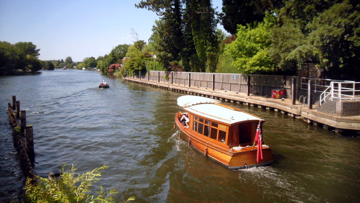
Marsh Lock is just upstream of Henley-on-Thames. The lock postcode is RG9 4HB. Its weir gantries and long approach bridges are striking riverside landmarks.
Marsh Head Horsebridge remains closed. The Environment Agency closed it in May 2022 after structural inspections. Its latest project information explains the replacement plans and funding work.
Walkers between Shiplake and Henley should follow the official Thames Path diversion. The downstream tail horsebridge is a separate structure and has also required repairs; check current access rather than relying on older descriptions of an unrestricted crossing.
Walking access and boat passage are different checks
Checked 4 October 2026: the Environment Agency still lists the upstream horsebridge as closed with a signed diversion. This is a footbridge restriction; it does not by itself establish whether the lock is open to boats.
Official bridge and facilities listing · Separate navigation notices.
EXPLORE THE THAMES
Marsh Horsebridge and the working river
The long Marsh Horsebridge route reflects the days when horses towed barges along the Thames. The Environment Agency dates the first bridge at the site to 1796 and notes major refurbishment of the current head bridge in the 1990s.
The original guide described a replacement bridge with steel construction as safer than its predecessor. Subsequent inspections and the present closure mean that description must be read as historical, not as current access advice.
EXPLORE THE THAMES
Marsh Lock and the riverside mills
Records of a lock here reach back to the early 1400s. A flash lock served the river before the first pound lock in 1773.
The original account describes milling on both banks: corn mills on the Berkshire side, with corn and paper milling on the Oxfordshire side. The river provided both power and transport.
The first pound lock was mainly wooden, with an oak rebuild in 1787, fourteen years later. The Thames Conservancy rebuilt it in 1886 and again in 1914. Hydraulic operation followed in 1962.
An engineering connection
Thacker links the original lock’s construction with Humphrey Gainsborough, the Henley minister and brother of the painter Thomas Gainsborough. His account also dates the first lock house to 1813. These details relate to earlier works, rather than the present bridge or machinery.
Research source: F. S. Thacker, The Thames Highway: Marsh. Checked 4 October 2026.
EXPLORE THE THAMES
Hennerton Backwater
Hennerton Backwater is a roughly mile-and-a-half side channel between Henley and Wargrave, upstream of Marsh Lock.
The original guide records restoration that enabled small boats and canoes to use the channel. It is an account of past improvements, not confirmation of today’s clearances or access. Check local conditions, obstructions and the suitability of your craft before entering a backwater.
EXPLORE THE THAMES
Wildlife at Marsh Lock
These wildlife details come from our earlier local account, not a current survey or a guarantee of sightings.
The lock’s local account records buzzards, hobbies, kingfishers and Egyptian geese, with an occasional black swan.
Anglers have also reported brown trout in the river here. Observe from accessible public paths and respect bridge closures and working areas.
ON THE WATER
Boating through Marsh Lock
Shiplake Lock is 4.80 km (2.98 miles) upstream. The next lock downstream is Hambleden Lock, 4.59 km (2.85 miles) away by river.
Published lock dimensions
- Length
- 41.19 m
- Width
- 6.42 m
- Fall
- 1.33 m
- Upper sill depth
- 2.18 m
- Lower sill depth
- 2.18 m
Source: Environment Agency distances and measurements. Published dimensions and sill depths do not guarantee navigable clearance. Check water levels, the full guidance and current restrictions.
Consult the lock keeper service and follow the instructions displayed at the lock.
Neighbouring reaches: cruising estimates
| Reach | km / miles | EA estimate |
|---|---|---|
| Shiplake → Marsh | 4.80 / 2.98 | 36 minutes |
| Marsh → Hambleden | 4.59 / 2.85 | 35 minutes |
The Environment Agency estimates assume 8 km/h. Add waiting and lock-passage time; conditions can lengthen journeys. These are river distances, not walking distances.
Facilities at Marsh Lock
- card and contactless payments
Checked 4 October 2026 against the Environment Agency facilities guide. Availability can change; check the official guide and signs on site.
BEFORE YOU SET OFF
River conditions at Marsh Lock
Check stream warnings and navigation closures separately. A lack of stream warnings does not confirm that a lock is open.
Older local conditions snapshot
Source date: (yesterday; date only). Publication details: (1 day ago). This is not a warning start time.
Snapshot retrieved: (1 day ago).
The latest update check was unsuccessful: (8 minutes ago). The previous source date and snapshot above have not been refreshed.
These previously recorded conditions are older than the expected daily source update window. Check the official service.
Check official river conditions and restrictions and closures. Navigation closures, flood alerts and walking or access conditions are not assessed by this snapshot.
Recorded water observations
The Stage and Downstream Stage readings use separate local trace scales (mASD). They are not water depth, a shared sea-level reference or directly comparable values. No subtraction, gradient or navigation permission is inferred.
Marsh Lock — Stage
0.125 mASD — dated observation
Observed: (39 minutes ago). Retrieved: (8 minutes ago).
Marsh Lock — downstream stage
2.397 mASD — dated observation
Observed: (39 minutes ago). Retrieved: (8 minutes ago).
Environment Agency observations are shown with their original observation and retrieval times. Observation times are separate from river-condition publication dates; these snapshots do not provide a historical series.
Questions about Marsh Lock
Where is Marsh Lock?
It is just upstream of Henley-on-Thames, between Shiplake and Hambleden locks. The postcode is RG9 4HB.
Is Marsh Horsebridge open?
Marsh Head Horsebridge remains closed following structural concerns. Check the Environment Agency project page and the National Trail diversion before visiting; the tail horsebridge is a separate crossing.
What is Hennerton Backwater?
It is a side channel of the Thames between Henley and Wargrave, roughly a mile and a half long. Check access and conditions before taking a small boat into it.
About this guide
Published by The River Thames Guide. Research additions, measurements and facilities checked 4 October 2026. Sources are linked beside new material; earlier local accounts are retained where identified. Check changing access and navigation arrangements before travelling.
Contains public sector information licensed under the Open Government Licence v3.0. New research is written in original wording; no third-party archive images or maps have been copied. Existing photograph credits and licences are retained.


