 The River Thames Guide
EXPLORE THE THAMES
Visiting Shiplake Lock and the Thames Path
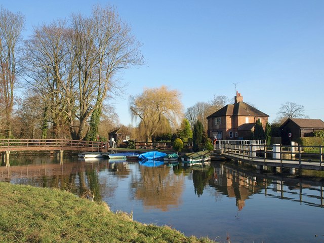
Shiplake Lock is on the Thames near Shiplake and Wargrave. The lock postcode is RG9 3NA. Use the official Thames Path map to plan public access, crossings and parking.
Walking towards Henley: the closure of Marsh Head Horsebridge affects the downstream Thames Path. Check the official Marsh Lock diversion before setting out; a continuous riverside route should not be assumed.
Plan servicing stops ahead
The Environment Agency currently marks Shiplake’s sewage pump-out and refuse disposal as closed. Check its latest facilities list before relying on either service.
EA facilities guide, checked 4 October 2026.
EXPLORE THE THAMES
St Patrick’s Stream and the River Loddon
Shiplake is unusual among Thames locks because St Patrick’s Stream and the River Loddon provide a route around it for suitable small paddlecraft without passing a weir.
The original guide describes entering St Patrick’s Stream about a mile upstream, following it into the Loddon and returning to the Thames just below the lock. It presents Shiplake as the only Thames lock with this particular weir-free bypass.
For route planning, consult Go Paddling’s St Patrick’s Stream trail. Assess flow, branches, low bridges, access and your own experience before choosing a backwater. This is not a bypass for larger motorboats, and the older reference to canoes and small dinghies is not a guarantee of current clearance.
EXPLORE THE THAMES
Wargrave and Shiplake Regatta
The Wargrave and Shiplake Regatta is a major local summer event, bringing participants and spectators to the river for two days in early August.
The regatta’s official website carries the next dates, entry information and visitor arrangements. Use its current announcement rather than assuming the same weekend each year.
EXPLORE THE THAMES
Shiplake Lock history
A fifteenth-century flash weir, possibly serving a mill, preceded the first pound lock. The Thames Navigation Commissioners built that lock in 1773 using fir wood. Rebuilding in oak followed, then stone in 1874.
The first hydraulic lock on the Thames
Shiplake was the first Thames lock to gain hydraulic power. An electro-mechanical system installed in 1956 proved unsatisfactory and was replaced five years later, in 1961.
This distinction complements Mapledurham’s earlier role in introducing mechanical operation to the river.
Why repairs mattered to trade
In 1787, repairs at Shiplake threatened to divert cheese shipments from Oxford and Lechlade onto the roads. Thacker records the pressure to restore navigation quickly: the lock was part of a competitive freight route, not simply a local river crossing.
Research source: F. S. Thacker, The Thames Highway: Shiplake. Checked 4 October 2026.
ON THE WATER
Boating through Shiplake Lock
Sonning Lock is 4.68 km (2.91 miles) upstream. The next lock downstream is Marsh Lock, 4.80 km (2.98 miles) away by river.
Published lock dimensions
- Length
- 40.64 m
- Width
- 5.56 m
- Fall
- 1.55 m
- Upper sill depth
- 1.98 m
- Lower sill depth
- 1.90 m
Source: Environment Agency distances and measurements. Published dimensions and sill depths do not guarantee navigable clearance. Check water levels, the full guidance and current restrictions.
Consult the lock keeper service and follow the instructions displayed at the lock.
Neighbouring reaches: cruising estimates
| Reach | km / miles | EA estimate |
|---|---|---|
| Sonning → Shiplake | 4.68 / 2.91 | 36 minutes |
| Shiplake → Marsh | 4.80 / 2.98 | 36 minutes |
The Environment Agency estimates assume 8 km/h. Add waiting and lock-passage time; conditions can lengthen journeys. These are river distances, not walking distances.
Facilities at Shiplake Lock
- card and contactless payments
- toilet
- drinking water tap (for portable containers only)
- bulk supply water point
- electric charging point
- chemical toilet disposal
- sewage pump-out - currently closed
- refuse disposal - currently closed
Checked 4 October 2026 against the Environment Agency facilities guide. Availability can change; check the official guide and signs on site.
Navigation notice: 5 October 2026
The Environment Agency’s notice schedules hand-wind-only operation on 5 October 2026, 9am–4pm, during electrical work. It also lists a tree obstruction at Phillimore Island in Shiplake reach, marked by navigation buoys. Check the live notice for changes before travelling.
EA navigation notices, checked 4 October 2026. The dated power-work notice applies only to the stated period.
BEFORE YOU SET OFF
River conditions at Shiplake Lock
Check stream warnings and navigation closures separately. A lack of stream warnings does not confirm that a lock is open.
For the latest information, check the official river conditions service below.
Questions about Shiplake Lock
Where is Shiplake Lock?
It is near Shiplake and Wargrave, between Sonning and Marsh locks. The postcode is RG9 3NA.
Can paddlers go around Shiplake Lock?
St Patrick’s Stream and the River Loddon form a small-craft route around the lock. Check the published paddle trail, access and current conditions; it is not suitable for every craft or level of experience.
Can I follow the Thames Path directly from Shiplake to Henley?
Marsh Head Horsebridge is closed, affecting the route downstream. Follow the current National Trail diversion and check updates before walking.
About this guide
Published by The River Thames Guide. Research additions, measurements and facilities checked 4 October 2026. Sources are linked beside new material; earlier local accounts are retained where identified. Check changing access and navigation arrangements before travelling.
Contains public sector information licensed under the Open Government Licence v3.0. New research is written in original wording; no third-party archive images or maps have been copied. Existing photograph credits and licences are retained.


