 The River Thames Guide
EXPLORE THE THAMES
Visiting Abingdon Lock and the riverside
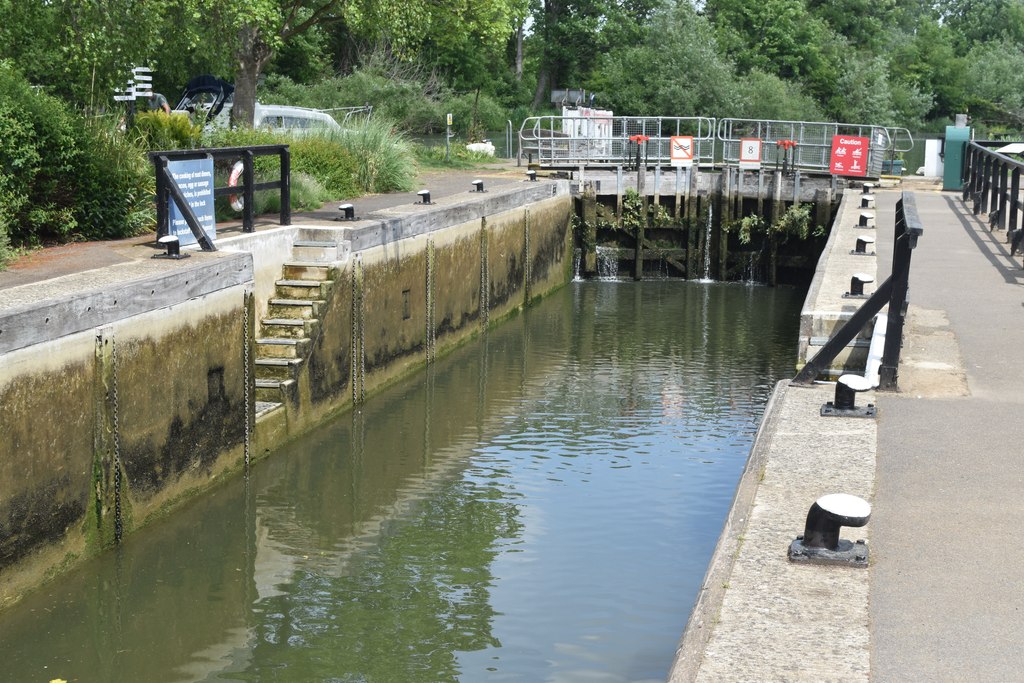
Abingdon Lock is a useful starting point for exploring the River Thames beside Abingdon-on-Thames. The lock postcode is OX14 3NW. Use public town parking and check your walking approach; the lock postcode does not guarantee vehicle access.
Plan a route using the official Thames Path map. The town’s bridges, riverside paths and Barton Fields Nature Reserve offer different ways to extend a visit.
Abingdon Town Council’s bridge history traces the crossing to 1416. This historic, protected bridge group is more than 600 years old, with alterations over the centuries; it connects the town with the river’s wider navigation story.
Planning a service stop
Abingdon’s listed services include bulk water, chemical-toilet disposal and refuse disposal. The pump-out is available only when the lock keeper is on duty, so confirm staffing and availability before planning around it.
EA facilities guide, checked 4 October 2026.
EXPLORE THE THAMES
Abingdon Lock and the early lock at Swift Ditch
Abingdon is a compact, hydraulically operated lock with controls on the lockside. The original guide described it as the smallest main lock below Oxford; the published dimensions below give the more useful comparison for boaters.
One of the Thames’s earliest surviving lock chambers
The remains at the head of Swift Ditch belong to the early seventeenth-century improvements to Thames navigation. The older guide used a date of around 1635. Historic England’s Grade II listing dates the chamber to about 1620 and describes stone sides with nineteenth-century brick repairs, rather than a concrete chamber.
Swift Ditch is an old course of the Thames around the south of Abingdon. Its surviving chamber is an important early example, although claims that it is the oldest in the UK or Europe should be treated cautiously. The old guide also records its later use as a weir.
The listing records the dismantling of the old lock’s tackle in 1790, associated with Abingdon Lock. The 1905 date in the former guide relates to a later rebuilding of Abingdon Lock, not the first replacement of the Swift Ditch route.
Bringing navigation back past the town
Thacker records construction starting on 21 April 1790. The scheme returned the main navigation from Swift Ditch to the route past Abingdon, linking the lock’s story with the town’s riverside trade.
Research source: F. S. Thacker, The Thames Highway: Abingdon. Checked 4 October 2026.
EXPLORE THE THAMES
Barton Fields and wildlife near Abingdon Lock
These wildlife details come from our earlier local account, not a current survey or a guarantee of sightings.
Barton Fields Nature Reserve borders the Thames on Abingdon’s eastern outskirts. Its wetlands, meadow, grassland and willow habitat support a varied wildlife community. It became a Jubilee Wildlife Site in 2003, described in the earlier guide as a Jubilee Wildlife Space.
The lock’s local wildlife account records great crested grebes, red kites and an occasional osprey. Sightings vary with the season; quiet observation from public paths gives the best chance of enjoying the river without disturbing its wildlife.
EXPLORE THE THAMES
Abingdon’s dragon boat racing tradition
Dragon Boat Racing is part of Abingdon’s riverside event history. The earlier guide describes crowds gathering near the lock for races in boats based on traditional Chinese craft.
Its account describes 40-foot boats carrying 10 to 16 paddlers plus a drummer, whose beat keeps the crew in time. Event formats and dates can change; check the Thames events guide and an organiser’s current announcement before making a special journey.
ON THE WATER
Boating through Abingdon Lock
Sandford Lock is 7.38 km (4.58 miles) upstream. The next lock downstream is Culham Lock, 4.15 km (2.58 miles) away by river.
Published lock dimensions
- Length
- 36.57 m
- Width
- 5.71 m
- Fall
- 1.89 m
- Upper sill depth
- 2.64 m
- Lower sill depth
- 1.52 m
Source: Environment Agency distances and measurements. Published dimensions and sill depths do not guarantee navigable clearance. Check water levels, the full guidance and current restrictions.
Consult the lock keeper service and follow the instructions displayed at the lock.
Neighbouring reaches: cruising estimates
| Reach | km / miles | EA estimate |
|---|---|---|
| Sandford → Abingdon | 7.38 / 4.58 | 56 minutes |
| Abingdon → Culham | 4.15 / 2.58 | 32 minutes |
The Environment Agency estimates assume 8 km/h. Add waiting and lock-passage time; conditions can lengthen journeys. These are river distances, not walking distances.
Facilities at Abingdon Lock
- card and contactless payments
- drinking water tap (for portable containers only)
- bulk supply water point
- chemical toilet disposal
- sewage pump-out - (available only when Lock Keeper on duty)
- refuse disposal
Checked 4 October 2026 against the Environment Agency facilities guide. Availability can change; check the official guide and signs on site.
Shoal below the lock
Checked 4 October 2026: the Environment Agency lists a buoy-marked shoal downstream of Abingdon Lock. Consult its latest navigation notice and follow the on-site markings.
BEFORE YOU SET OFF
River conditions at Abingdon Lock
Check stream warnings and navigation closures separately. A lack of stream warnings does not confirm that a lock is open.
For the latest information, check the official river conditions service below.
Questions about Abingdon Lock
Where is Abingdon Lock?
It is beside Abingdon-on-Thames in Oxfordshire, between Sandford and Culham locks. The lock postcode is OX14 3NW.
What is Swift Ditch?
Swift Ditch is an old course of the Thames near Abingdon. The remains of an early seventeenth-century pound lock survive at its head.
What is there to see near Abingdon Lock?
Riverside paths link the area with Abingdon’s historic bridges and Barton Fields Nature Reserve. Check the Thames Path map for the route and any diversions.
About this guide
Published by The River Thames Guide. Research additions, measurements and facilities checked 4 October 2026. Sources are linked beside new material; earlier local accounts are retained where identified. Check changing access and navigation arrangements before travelling.
Contains public sector information licensed under the Open Government Licence v3.0. New research is written in original wording; no third-party archive images or maps have been copied. Existing photograph credits and licences are retained.


