 The River Thames Guide
EXPLORE THE THAMES
Visiting Blake’s Lock
Blake’s Lock is on the River Kennet near central Reading and the Thames confluence. Plan your public walking route using the official Thames Path map. The postcode in this guide locates the lock; check parking and the final approach separately.
For a town-and-river walk, follow Reading Museum’s directions through the Abbey Quarter to its Riverside Museum.
Boaters: a temporary 2.8 m vessel-beam restriction applies. Read the repair notice linked below before planning passage.
Museum visits checked 6 October 2026: the Riverside Museum advertises April–September opening. An October visit falls outside that advertised season; check with the museum before planning to enter the buildings.
EXPLORE THE THAMES
The Kennet, the Thames and canal navigation
Blake’s Lock is on the River Kennet, near its meeting with the Thames. It is part of the route into the Kennet & Avon Canal, whose wider navigation has more than 100 locks.
The lock is unusual within the Environment Agency’s Thames navigation because it is on a tributary rather than the Thames itself. That does not mean it is the only off-Thames lock managed by the Environment Agency nationally. The wider canal is now managed by the Canal & River Trust, successor in this role to British Waterways.
EXPLORE THE THAMES
From flash lock to manually operated pound lock
Blake’s was originally a flash lock, associated in the old guide with the Kennet & Avon Company. It became a timber pound lock in 1802, improving passage between the Thames and the River Kennet. The complete through route towards Bristol followed when the canal was completed in 1810, as described in the Canal & River Trust’s history.
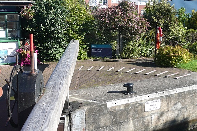
The lock is known for its manual beams rather than hydraulic operation. Current repair restrictions matter: the Environment Agency’s notice from 30 July 2026 says a damaged balance beam has been removed and restricts passage to vessels with a beam of 2.8 m until further notice. This restriction takes precedence over the chamber’s nominal width below.
The keeper and the Kennetmouth ferry
Thacker records James White taking charge of the Kennetmouth ferry at the end of 1812, with responsibility for Blake’s Lock included in his duties. The two river jobs were once closely connected.
Research source: F. S. Thacker, The Thames Highway: Kennetmouth ferry. Checked 6 October 2026.
EXPLORE THE THAMES
The Riverside Museum at Blake’s Lock
The Riverside Museum tells the story of Reading’s two rivers in former waterworks buildings. Exhibits include a traditional Romani caravan — described as a gypsy caravan in the collection — a medieval mill wheel and preserved turbine machinery.
The museum currently lists daily opening from April to September, with free admission. Its former riverside pub and restaurant, latterly The Narrowboat, closed in 2024; Fullers now operates a Kitchen Academy on part of the site, which is not open to the public. Check the museum’s visitor information before travelling.
The original guide describes views towards Reading Prison and associates 1862 with Reading’s last public execution. This is a local historical reference, not the date of the last public execution in Britain. Oscar Wilde was imprisoned at Reading, an experience associated with The Ballad of Reading Gaol.
EXPLORE THE THAMES
Wildlife beside Blake’s Lock
These wildlife details come from our earlier local account, not a current survey or a guarantee of sightings.
The local account records blue tits, finches, wren, jackdaws, geese and ducks, with a heron sometimes seen on the lock house. Watch quietly from public paths and keep the working lock areas clear.
ON THE WATER
Boating through Blake's Lock
Blake’s is on the Kennet, not between two consecutive Thames locks. On the Thames near Kennetmouth, explore Caversham Lock upstream and Sonning Lock downstream. For the canal beyond Reading, check Canal & River Trust stoppages as well as Environment Agency notices.
Published lock dimensions
- Length
- 37.39 m
- Width
- 5.75 m
- Fall
- 1.07 m
- Upper sill depth
- 1.80 m
- Lower sill depth
- 1.63 m
Source: Environment Agency distances and measurements. Published dimensions and sill depths do not guarantee navigable clearance. Check water levels, the full guidance and current restrictions.
Consult the lock keeper service and follow the instructions displayed at the lock.
Facilities at Blake's Lock
The Environment Agency lists no facilities at this lock.
Checked 6 October 2026 against the Environment Agency facilities guide. Availability can change; check the official guide and signs on site.
Current vessel-width restriction
Checked 6 October 2026: the EA repair notice still restricts passage to vessels with a beam of 2.8 m, following removal of a damaged balance beam. This is narrower than the published chamber width. Follow staff instructions and check the notice again before travelling.
BEFORE YOU SET OFF
River conditions at Blake's Lock
Check stream warnings and navigation closures separately. A lack of stream warnings does not confirm that a lock is open.
For the latest information, check the official river conditions service below.
Questions about Blake's Lock
Is Blake’s Lock on the Thames?
It is on the River Kennet in Reading, but managed as part of the Environment Agency’s Thames navigation.
Is Blake’s Lock hydraulic?
It is manually operated. Check the current repair notice: a damaged beam has led to a temporary vessel-width restriction.
When can I visit the Riverside Museum?
The museum currently lists daily opening from April to September with free admission. Check its own website for the latest access arrangements.
About this guide
Published by The River Thames Guide. Research additions, measurements and facilities checked 6 October 2026. Sources are linked beside new material; earlier local accounts are retained where identified. Check changing access and navigation arrangements before travelling.
Contains public sector information licensed under the Open Government Licence v3.0. New research is written in original wording; no third-party archive images or maps have been copied. Existing photograph credits and licences are retained.


