 The River Thames Guide
EXPLORE THE THAMES
Visiting Radcot Lock and the Thames Path
Radcot Lock is on the upper River Thames in Oxfordshire. Combine a visit with a riverside walk in the area around Radcot’s bridges, using the official Thames Path map to plan crossings and your return route.
The lock postcode is SN7 8JT. This locates the lock rather than a confirmed public car park. Check parking permissions and public footpaths before setting out, and expect uneven or muddy ground after rain.
The distances to neighbouring locks below are measured along the river for boaters; walking distances will differ.
EXPLORE THE THAMES
Radcot Bridge, Domesday and Matilda
The name Radcot has been interpreted as “cottage by the road”. The old stone bridge is traditionally described as the oldest bridge over the River Thames; Historic England records Radcot Bridge as a scheduled monument.
Our original history links the crossing to the 1086 Domesday Book, King William the Conqueror and Alsi of Faringdon. The route’s strategic importance made Radcot a contested place in later centuries.
Matilda’s castle
The earthworks north of the bridge are associated with Matilda, Countess of Anjou, and her struggle with King Stephen. Archaeological research places the fortification in the 1140s, not 1171 as stated in our earlier guide. The Wessex Archaeology report (PDF) discusses the site and the 1142 fortification.
The earlier guide points to remains north of the Swan Inn. Respect private land and use public paths when exploring the area.
Canal Bridge, Pidnell Bridge and stone boats
Canal Bridge and Pidnell Bridge are also part of Radcot’s story. Our local account connects the development of the crossings and navigation with the transport of good-quality building stone to London, when river boats carried heavy cargo through this rural landscape.
Stone and timber waiting for passage
In March 1867 a Stroud builder asked about repairs to Harper’s Weir so timber and stone could reach Hinton church by barge, Thacker records.
Research source: F. S. Thacker, The Thames Highway: Radcot. Checked 6 October 2026.
EXPLORE THE THAMES
From flash weirs to Radcot Lock
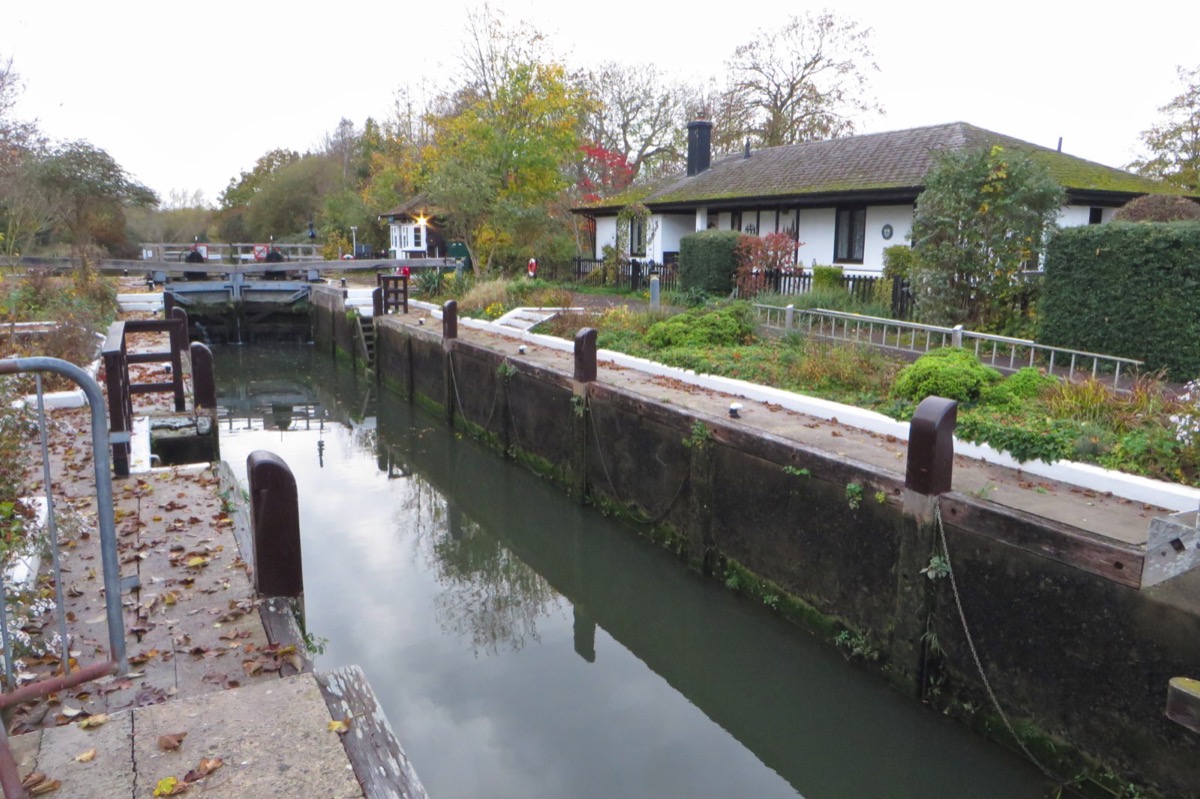
A manual-beam pound lock was constructed here in 1892, succeeding the earlier flash-lock system recorded from the mid 1700s. The old account names Clarke’s, Beck’s, Buck’s and Harper’s Weirs.
It also preserves an early description of a rough railing stretching across the stream between willows and a bank with two thatched dwellings. That image conveys how different the working river looked before the later lock chamber and gardens.
EXPLORE THE THAMES
Gardens and wildlife at Radcot Lock
These wildlife details come from our earlier local account, not a current survey or a guarantee of sightings.
The gardens, flowers, shrubs and fruit trees are a distinctive part of our original Radcot guide. Its wildlife record includes otters, grass snakes, curlews, kestrels, buzzards, red kites and kingfishers, with occasional visits by an egret.
Among the insects reported were the scarlet tiger moth and a hawk moth. These are local observations rather than guaranteed sightings. Watch quietly from the paths and leave plants and riverbank habitats undisturbed.
ON THE WATER
Boating through Radcot Lock
Grafton Lock is 2.98 km (1.85 miles) upstream. The next lock downstream is Rushey Lock, 4.23 km (2.63 miles) away by river.
Published lock dimensions
- Length
- 34.59 m
- Width
- 4.57 m
- Fall
- 1.48 m
- Upper sill depth
- 1.49 m
- Lower sill depth
- 1.54 m
Source: Environment Agency distances and measurements. Published dimensions and sill depths do not guarantee navigable clearance. Check water levels, the full guidance and current restrictions.
Consult the lock keeper service and follow the instructions displayed at the lock.
Neighbouring reaches: cruising estimates
| Reach | km / miles | EA estimate |
|---|---|---|
| Grafton → Radcot | 2.98 / 1.85 | 23 minutes |
| Radcot → Rushey | 4.23 / 2.63 | 32 minutes |
The Environment Agency estimates assume 8 km/h. Add waiting and lock-passage time; conditions can lengthen journeys. These are river distances, not walking distances.
Facilities at Radcot Lock
- toilet
- drinking water tap (for portable containers only)
- bulk supply water point - currently closed
Checked 6 October 2026 against the Environment Agency facilities guide. Availability can change; check the official guide and signs on site.
Canal Bridge damage
Checked 6 October 2026: the Environment Agency reports vehicle damage to Canal Bridge, where the A4095 crosses the river at Radcot. Watch for falling debris when navigating nearby and consult the latest notice.
Dry-weather passage restrictions
Checked 6 October 2026: the EA still lists restrictions from St John’s to Osney, covering this lock. Passages during keeper hours are limited to one movement each way per half-hour. Overnight closures run from 30 minutes before duty ends until 30 minutes after duty starts the next day. Check current hours and the full notice when planning your arrival.
EA dry-weather navigation notice; arrangements remain subject to review.
BEFORE YOU SET OFF
River conditions at Radcot Lock
Check stream warnings and navigation closures separately. A lack of stream warnings does not confirm that a lock is open.
For the latest information, check the official river conditions service below.
Questions about Radcot Lock
Where is Radcot Lock?
Radcot Lock is on the upper River Thames in Oxfordshire, between Grafton and Rushey locks. Its postcode is SN7 8JT.
When was Radcot Lock built?
The pound lock dates from 1892 and replaced an earlier system of flash weirs. The nearby bridge and settlement have a much older history.
Is drinking water available at Radcot Lock?
The Environment Agency lists a drinking-water tap for portable containers. Its bulk water point is listed as closed; check the latest facilities information before relying on it.
About this guide
Published by The River Thames Guide. Research additions, measurements and facilities checked 6 October 2026. Sources are linked beside new material; earlier local accounts are retained where identified. Check changing access and navigation arrangements before travelling. The former 1171 date for Matilda’s fortification has been corrected using archaeological research.
Contains public sector information licensed under the Open Government Licence v3.0. New research is written in original wording; no third-party archive images or maps have been copied. Existing photograph credits and licences are retained.


